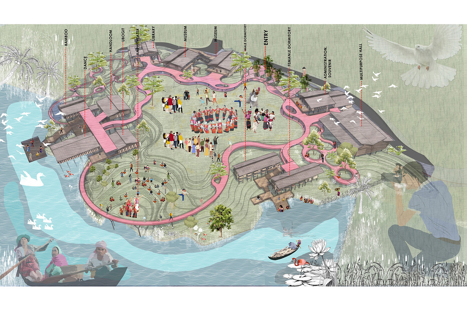
Coexistence: Community-based Tourism in Hakaluki Haor
Hakaluki Haor, a wetland of Bangladesh, is a shallow depression of bowl shape. In monsoon, the haor becomes vast stretches of turbulent water that turns into a vast inland sea within which the villages seem as islands. Again they all but dry up in the post-monsoon period. During winter, these haors are vast stretches of green land. Occasional large waves in the haor cause considerable damages to homesteads. Though the livelihood of the diverse community people is interrupted by this natural phenomenon the existence is sustained by means of co-existence (the magnificent ecological landscape, beels, birds, animals etc.). These are the main drives towards design process. The objectives of the project are ensuring community-based resiliency enrichment and also community-based tourism where developments are undertaken according to the diverse needs of the local community. Infrastructure including road network were developed respecting the nature of landscape. Resiliency is tried to ensure by maintaining existing geographic pattern by growing swamp forests and local materials which is one of the most significant strengths. Finally, approach was taken to uphold community-based tourism through development of the community activity and thus ensured an ecological tourism.


The study of the growth pattern of the existing household shows the characteristic composition of the houses around “courtyards”, which acts as hubs of the communal life. Also a very arbitrary fabric in the development of the settlements stands for a customary practice of the communities. Toilets are mostly open and unhygienic, built far from the living units, insufficiently serving the clusters since almost 40 members use one toilet. The number of houses are increasing with the increase in population.


The basic approach of the design was to create a courtyard based settlement, each unit having a courtyard in front of it, also different courtyards being connected via shared courtyards. The basic forms of the housing units are kept as unaltered as possible, only changed according to the use of the inhabitants. For example, the size of the courtyards in the farmers’ community is fully different from that of the fishermen community. Local materials like mud, bamboo, wattle and daub, reeds etc. are used and building shapes are kept unaltered to maintain the morphology, so that the tourists can get the true essence of the communal life observing the characteristic features of the buildings and the site. The community ponds are protected which are the most important feature in the villages. Religious buildings and schools are designed using materials according to the context, without any change in location, to house flood affected people in case of severe flood. Marketplaces are located in the most suitable places to connect with the communities.


The primary goal of the design was to achieve resiliency against flood due to the increase in the water level of large water bodies (beels) in the rainy season, which also submerges the paddy fields. This huge water flow becomes somewhat hazardous as it flows over human settlements and erodes the slope of the highlands.


Local people have taken some measures to secure themselves from the flood like raising flood wall, and fencing which is not really enough to withstand the strong wave of water. To ensure social, economic and structural resiliency, some natural measures are required to maintain an uninterrupted water flow of a reduced force. With this view in mind, the banks of the beels and the aisles and slope of the community mounds are utilized with natural materials and process without hampering the flow of water and resisting the degradation of the atmosphere. Reeds are abundant here which is used to reduce strength of the water flow.


The road network is developed by Swarm analysis where the parameters are determined according to human behaviors. Different logic are provided in the diagram. The areas of the mounds are fixed for controlling the increment of the population. Otherwise the natural diversity and the production land will be decreased.
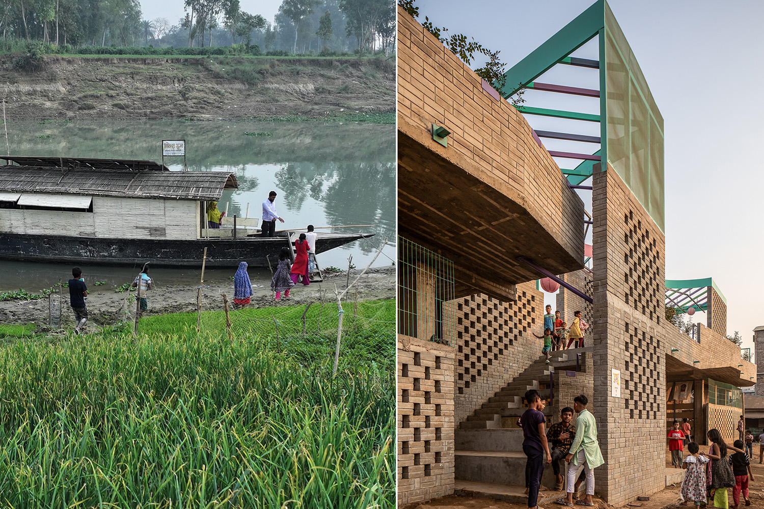
People all over Bangladesh visit haor mainly during the rainy season to enjoy the natural view of the waterscape. Heavy rain in the monsoon causes overflow of the huge waterbody and ultimately develop a magnificent natural beauty. More importantly, local inhabitants, having diversified occupations and respective lifestyle, intrigue visitors’ interest and curiosity.


The proposed roads in the internal communities can be used as trails for the tourists. Since all of the inhabitants might not be comfortable with the interruptions caused by the tourists, a visual barrier is created by trees around the house. Dense bushes are layers of large trees will create such a barrier that will affect the subconscious mind of the outsiders not to go beyond it. Also where the tree layer is thin, that will create a visual connection with the activities and people will feel invited to go and communicate with the locals. That might boost the possibilities of some economic development of the communities. Thus the green layer will govern the movement of the tourists.


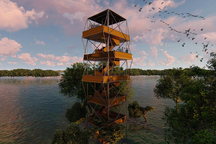
There is a special place of biodiversity locally called ‘Pakhighor‘ meaning ‘The nest of the Birds’. Seasonal birds gather here in the swamp areas. A trail to a limited distance is designed and provision for further development is kept. There is also a ‘Haor Visiting Centre’ for the tourists where people will be able to know about the haor. Near the beels, possibilities of oyster farming is also incorporated in the design.

| Image gallery |


PEOPLE ALSO VIEW


Printed Publications

NEXT 50: Collective Futures

ASPIRATIONS AND IDEAS: Designing with Context