Echoes of the Estuary: A Tourism Center at Hatiya Dwip
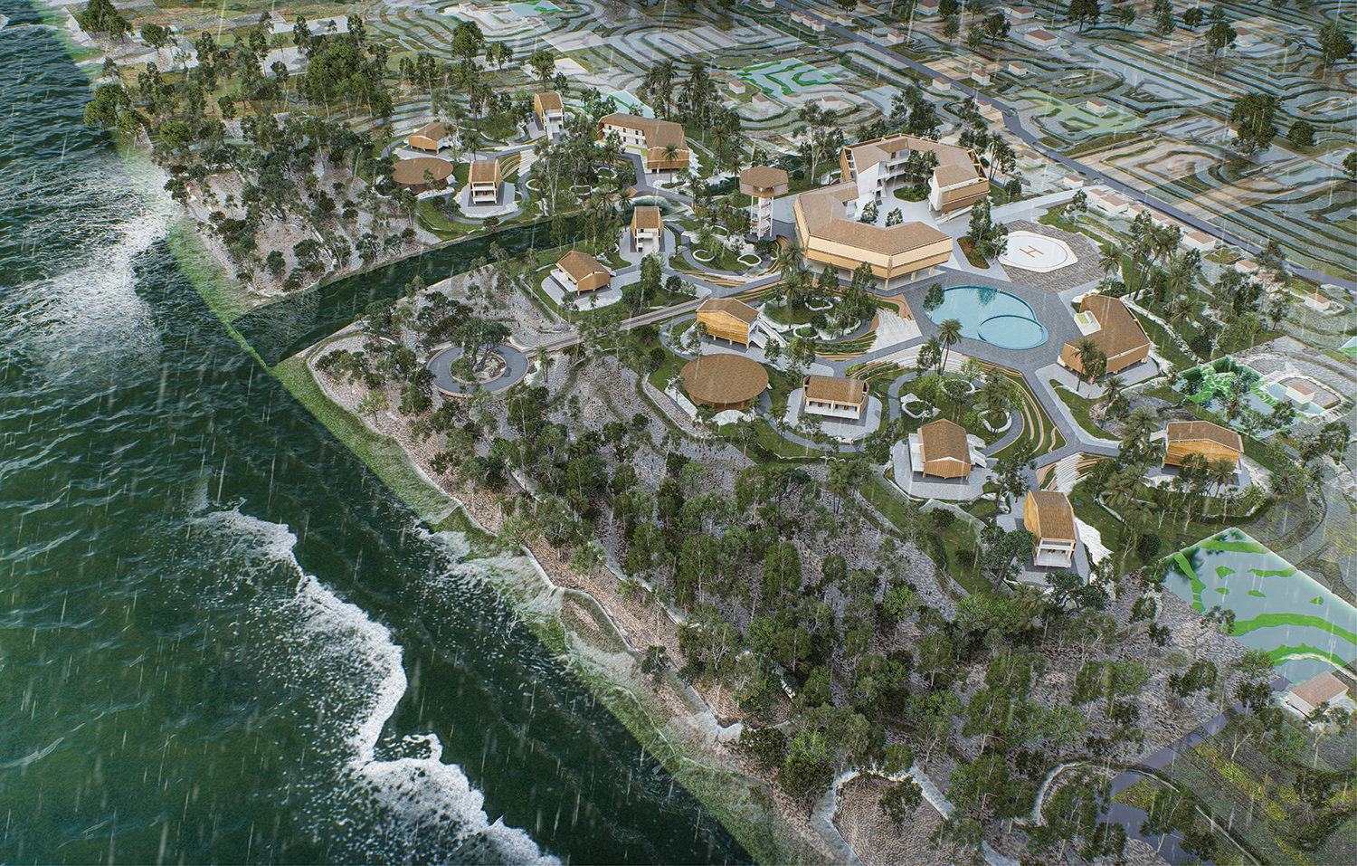
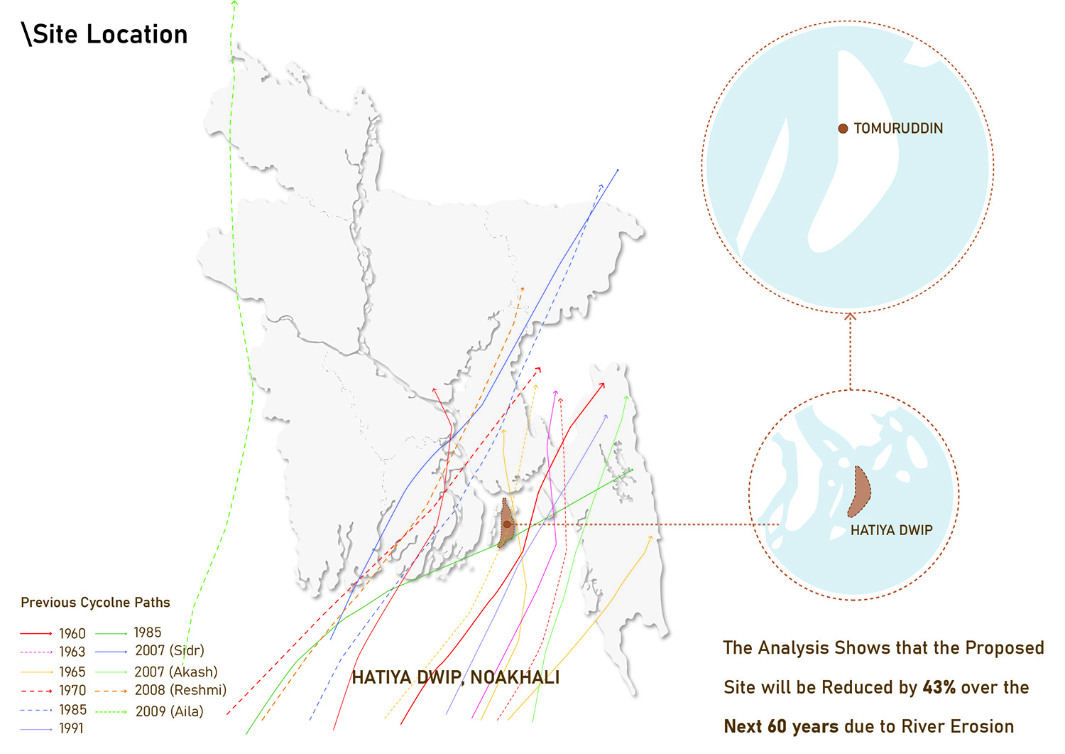
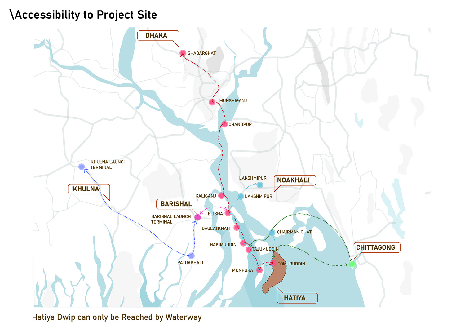
Hatiya Dwip is located in the south-eastern coastal region of Bangladesh at the Meghna River estuary, near the mouth of the Bay of Bengal. The island is highly vulnerable to environmental hazards such as cyclones, flooding, and river erosion. Due to its geographical isolation, water transport is the only means of access to the island. Despite these challenges, Hatiya Dwip possesses unique natural landscapes and ecological characteristics that offer significant potential for tourism development.
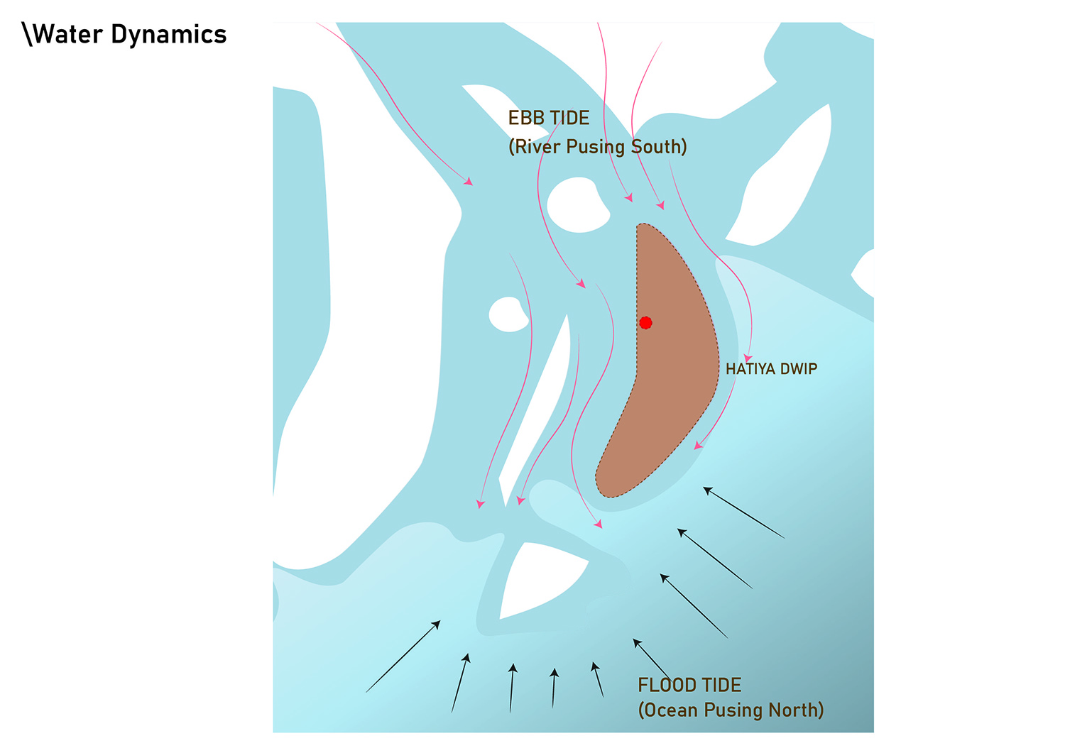
Being situated within the Meghna estuary, Hatiya Dwip is influenced by two major tidal dynamics: ebb tide and flood tide. The ebb tide flows from north to south, carrying the Meghna River’s water towards the Bay of Bengal. This current has high energy and exerts pressure on the northern shoreline, gradually causing erosion. At the same time, the river transports sediments southward. When this water meets the Bay of Bengal, the current slows down and deposits sediments along the southern part of the island, forming new land. As a result, the northern part of Hatiya Dwip continues to erode while the southern part gradually accretes. These processes indicate that the island is in a formative geomorphological stage.
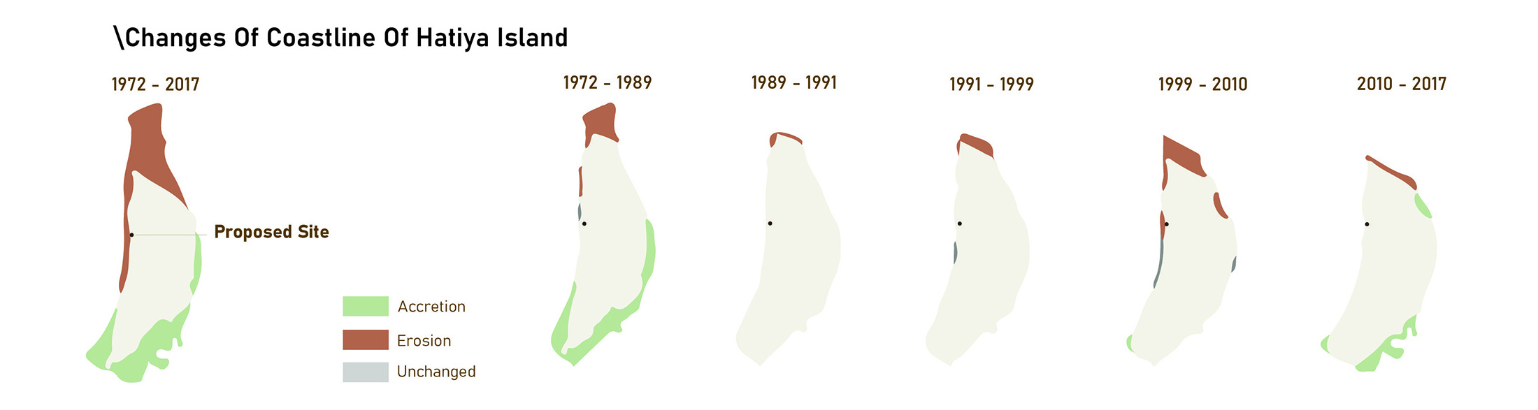
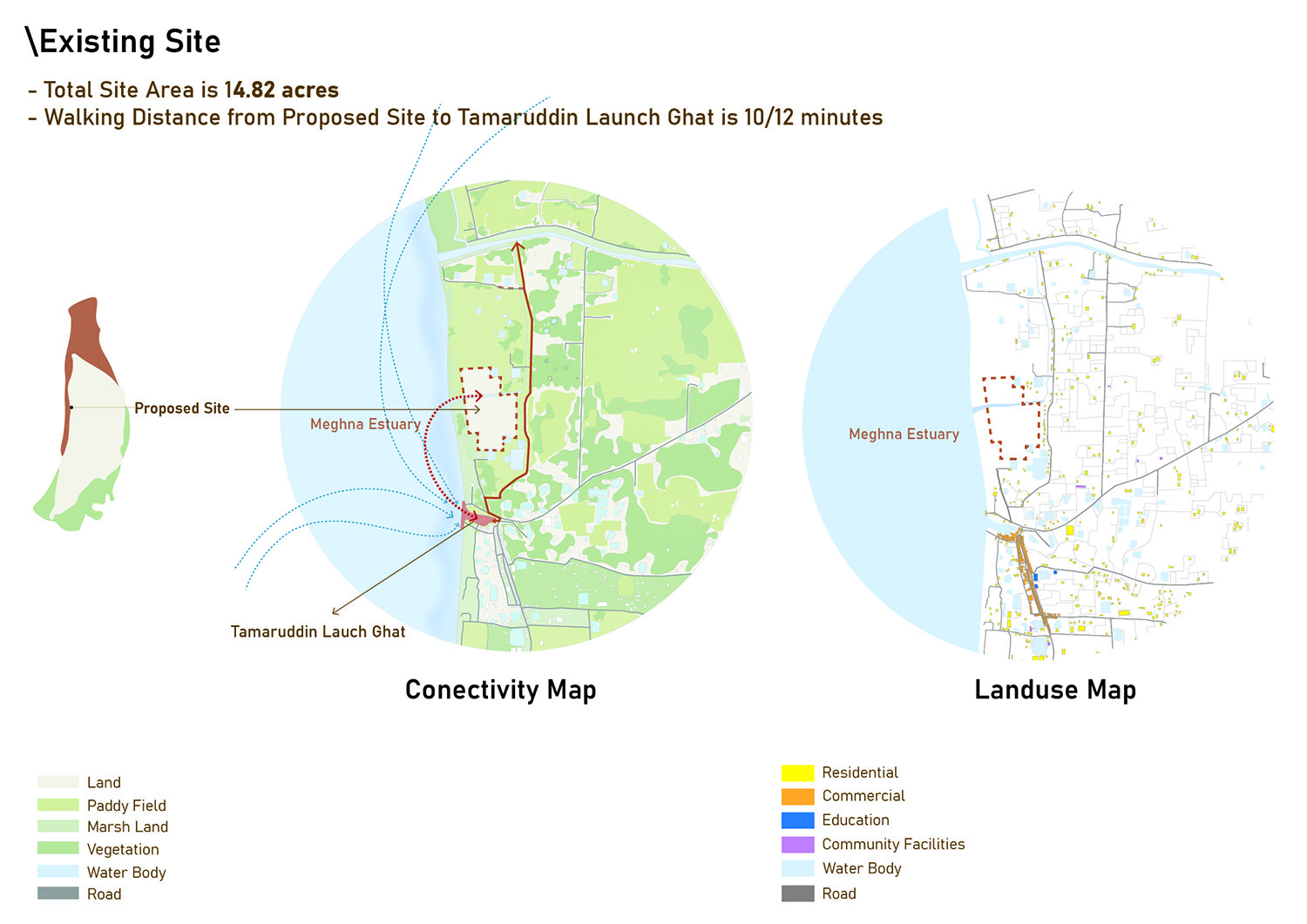
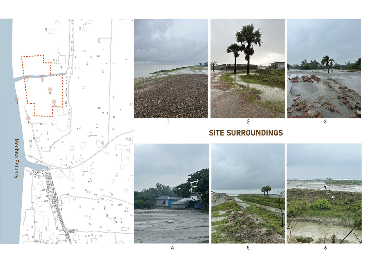
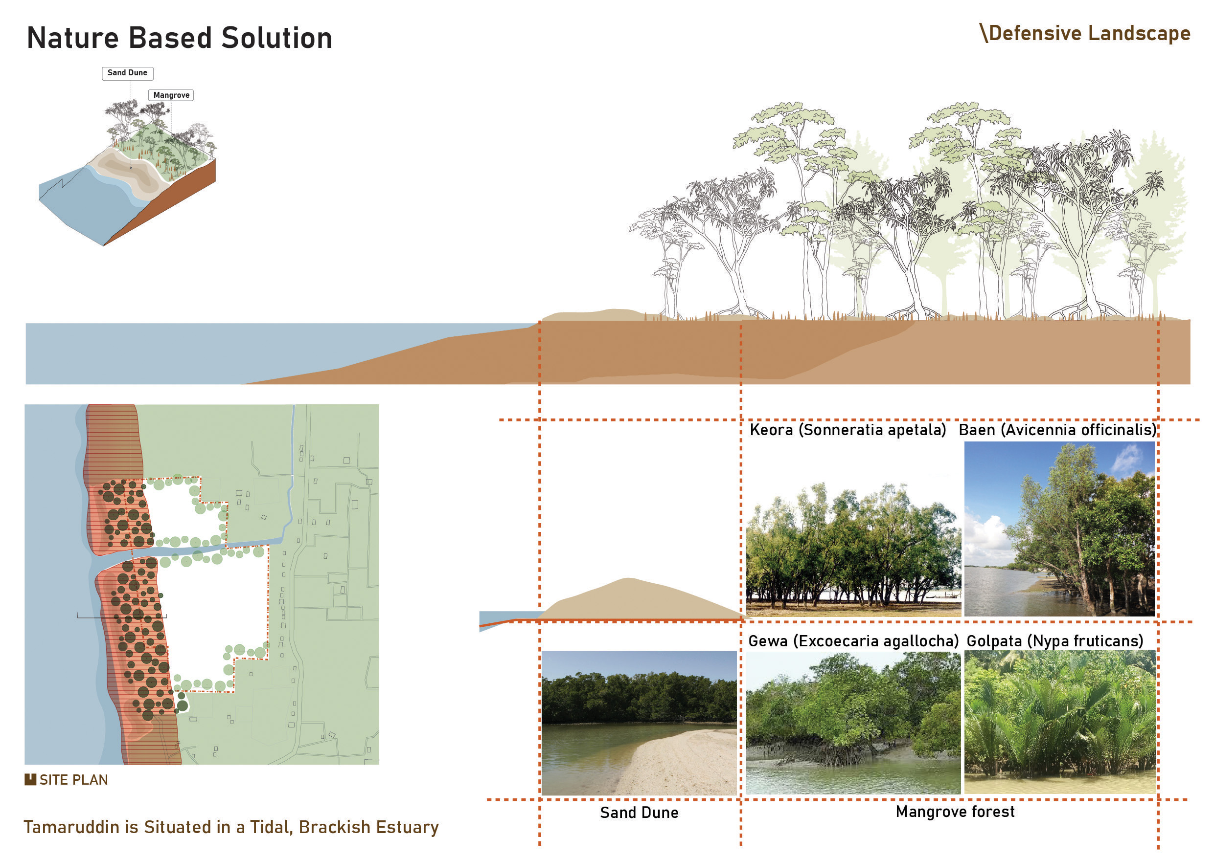
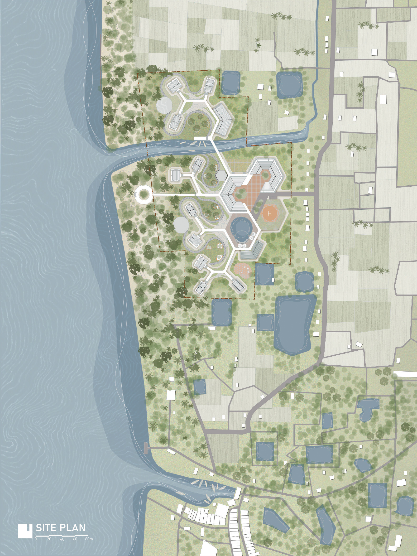
Historical analysis shows that erosion primarily occurs along the northern and western edges of the island, while land formation takes place in the southern region. Between 1972 and 2017, approximately 8 kilometers of land were eroded from the northern part of Hatiya Dwip. The proposed project site is located in Tamaruddin, on the western edge of the island along the bank of the Meghna River. The site covers an area of 14.82 acres. Tamaruddin Launch Ghat, the main transportation node connecting the island to mainland Bangladesh, lies approximately 10–12 minutes walking distance to the south of the site, and a pathway from the eastern edge of the site connects directly to it. The surrounding context consists of low-density residential settlements, while the project site itself has gradually turned into barren land due to environmental degradation.
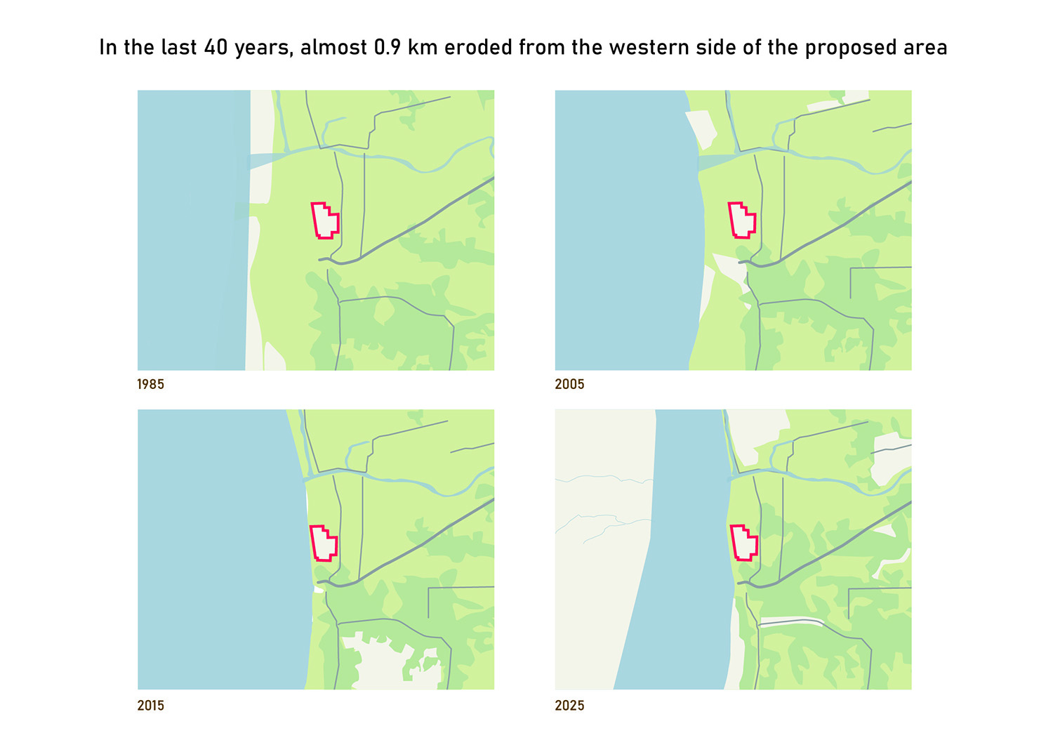
Historical mapping also shows that approximately 0.9 km of land has been eroded along the western side of the site during the last 40 years. Although the erosion rate has decreased by nearly 60% over every 20-year interval, projections indicate that approximately 43% of the site area may be eroded within the next 60 years.
The socio-economic condition of Hatiya Dwip is also fragile. Most residents depend on fishing and agriculture, both of which are seasonal occupations. Due to geographical isolation and limited employment opportunities, many residents become unemployed during off-seasons. Women are largely engaged in unpaid household activities with minimal access to income-generating work.
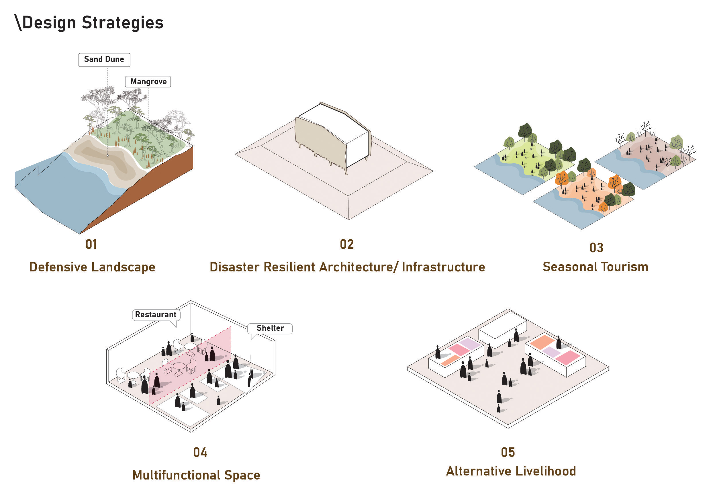
In response to these environmental and socio-economic challenges, the project introduces five key strategies: Defensive Landscape, Disaster-Resilient Architecture, Seasonal Tourism, Multifunctional Space, and Alternative Livelihood.
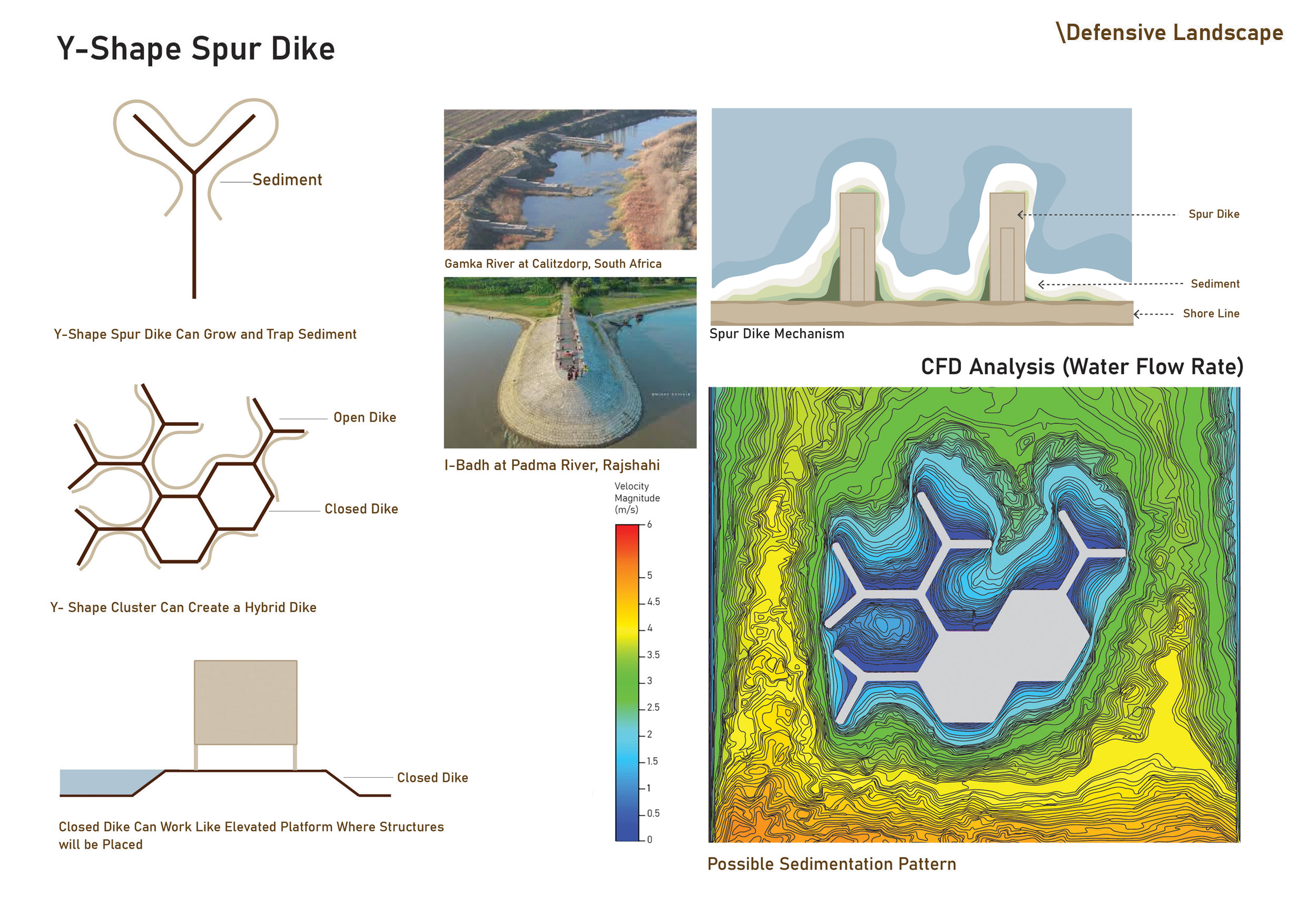
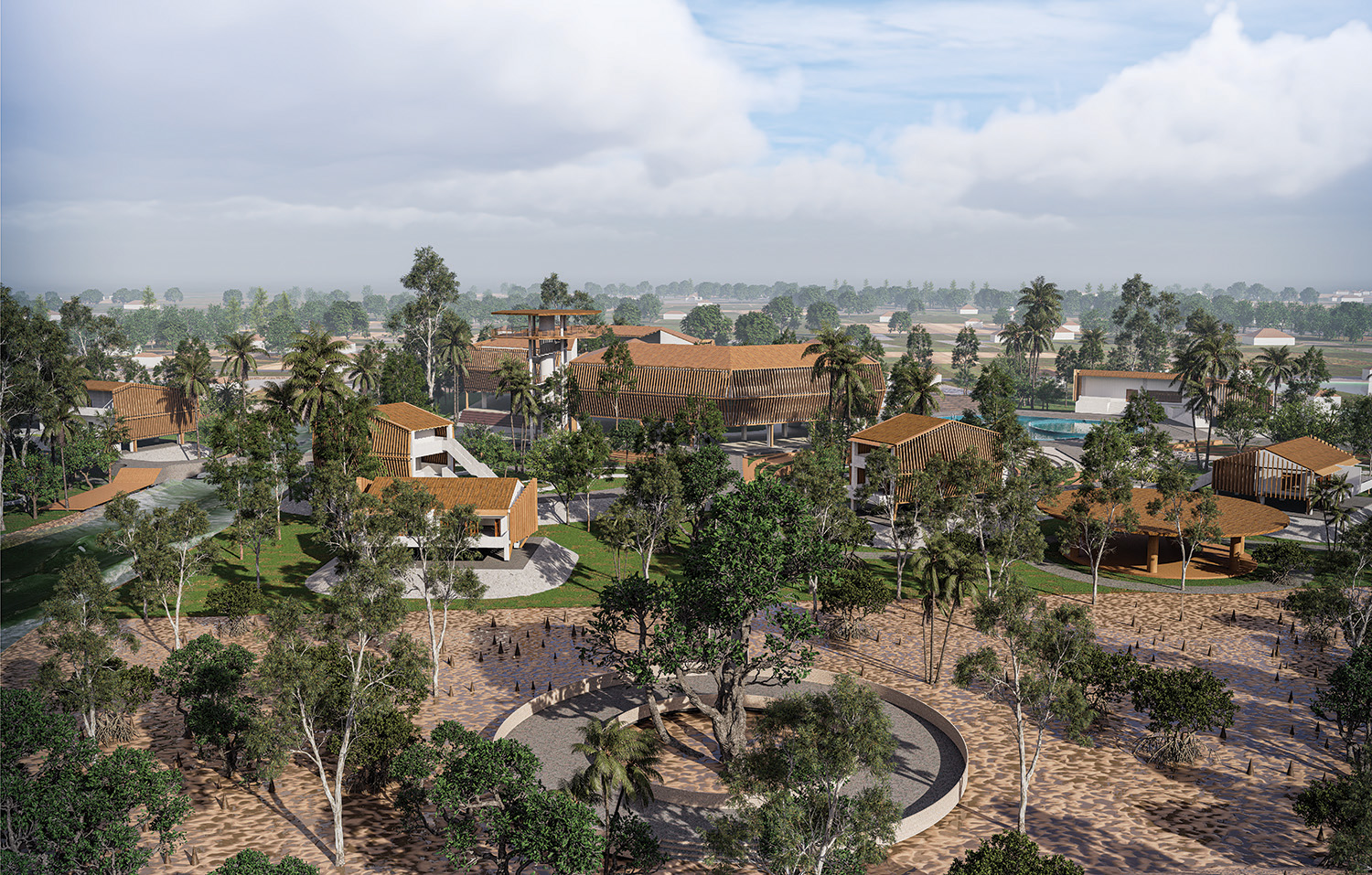
To mitigate river erosion and reduce cyclonic forces, a nature-based solution is proposed as the first line of defense. A green belt is introduced in areas predicted to erode within the next 20 years, incorporating mangrove plantation and sand dunes. Because the site is located in a brackish water environment, appropriate mangrove species are proposed. However, since the site is extremely vulnerable, nature-based solutions alone are not sufficient. Therefore, a second layer of protection is introduced through an engineering solution using a spur dike system. Spur dikes are man-made hydraulic structures generally placed perpendicular to the shoreline to prevent river erosion and protect riverbanks while also helping create new land. When sediment-carrying water hits the spur dike, the current slows down and deposits sediments at its edges, trapping sediments and gradually forming new land.
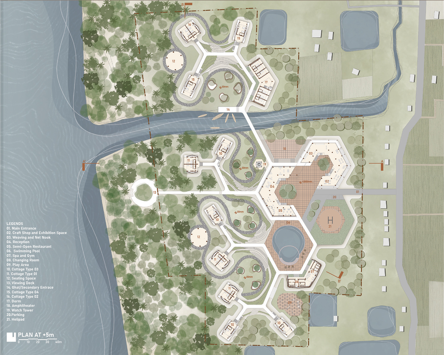
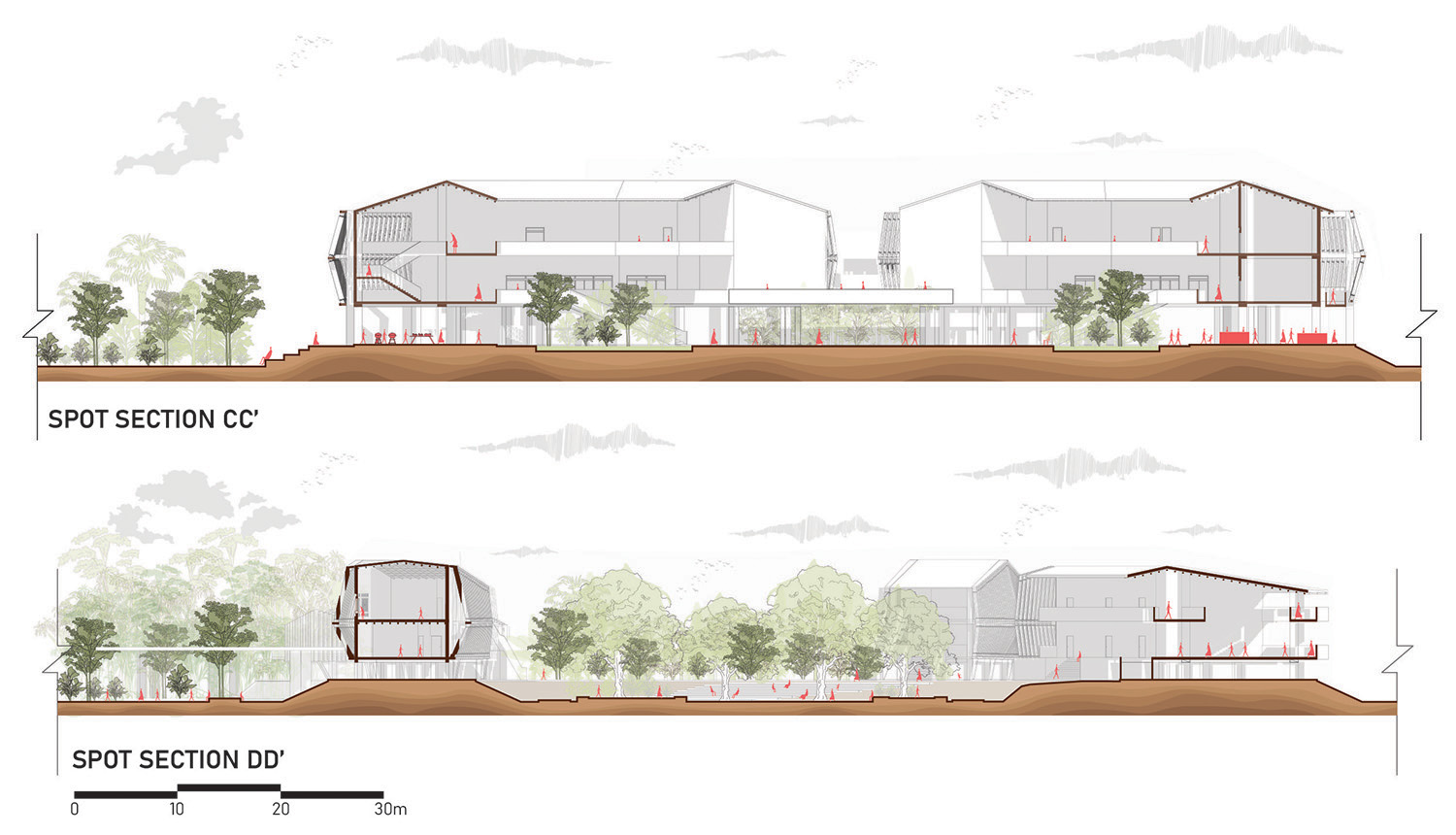
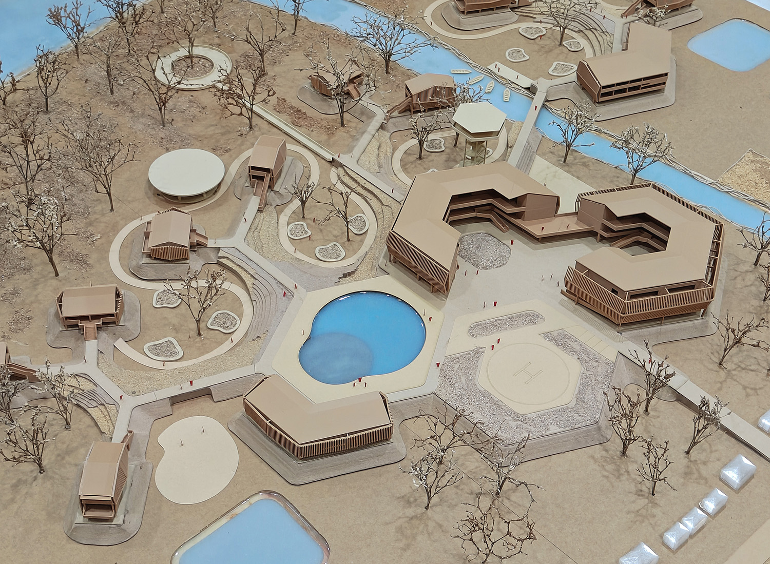
In this project, a Y-shaped spur dike system is proposed. The arms of the Y-shape can connect to form a hexagonal configuration where some arms remain open and others closed, creating a hybrid dike system. The open dikes trap sediments and help form new land, while the closed dikes act as elevated platforms for building structures. These platforms are elevated 2 meters above the land.
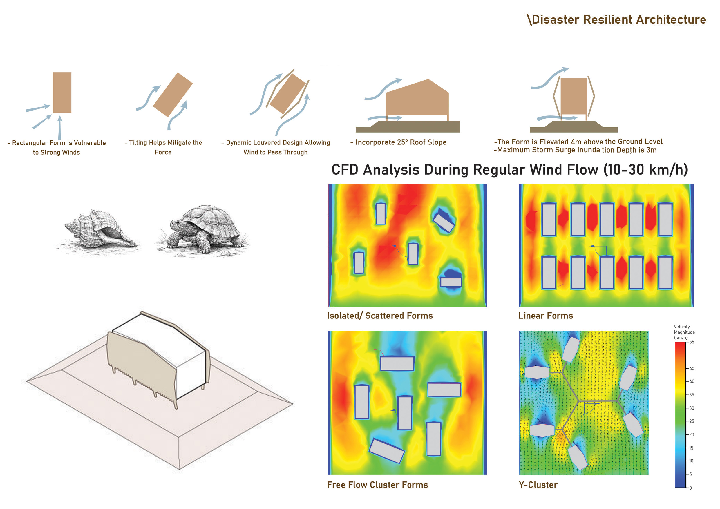
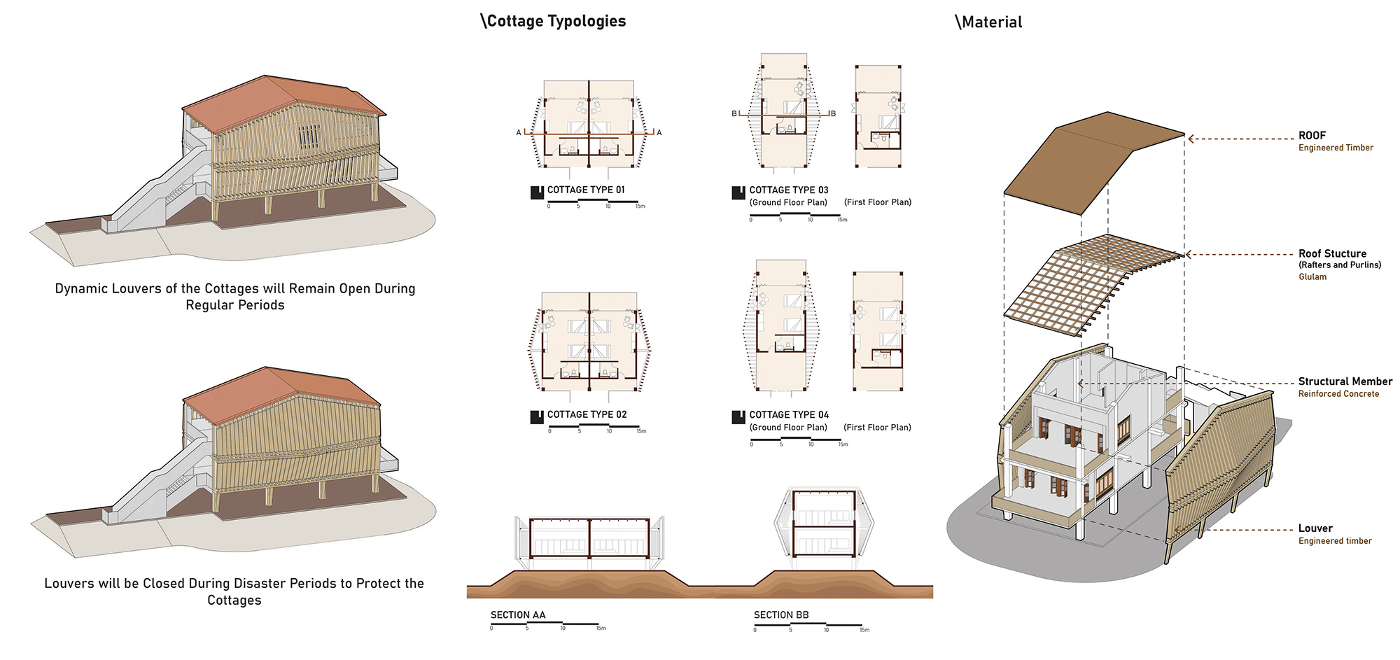
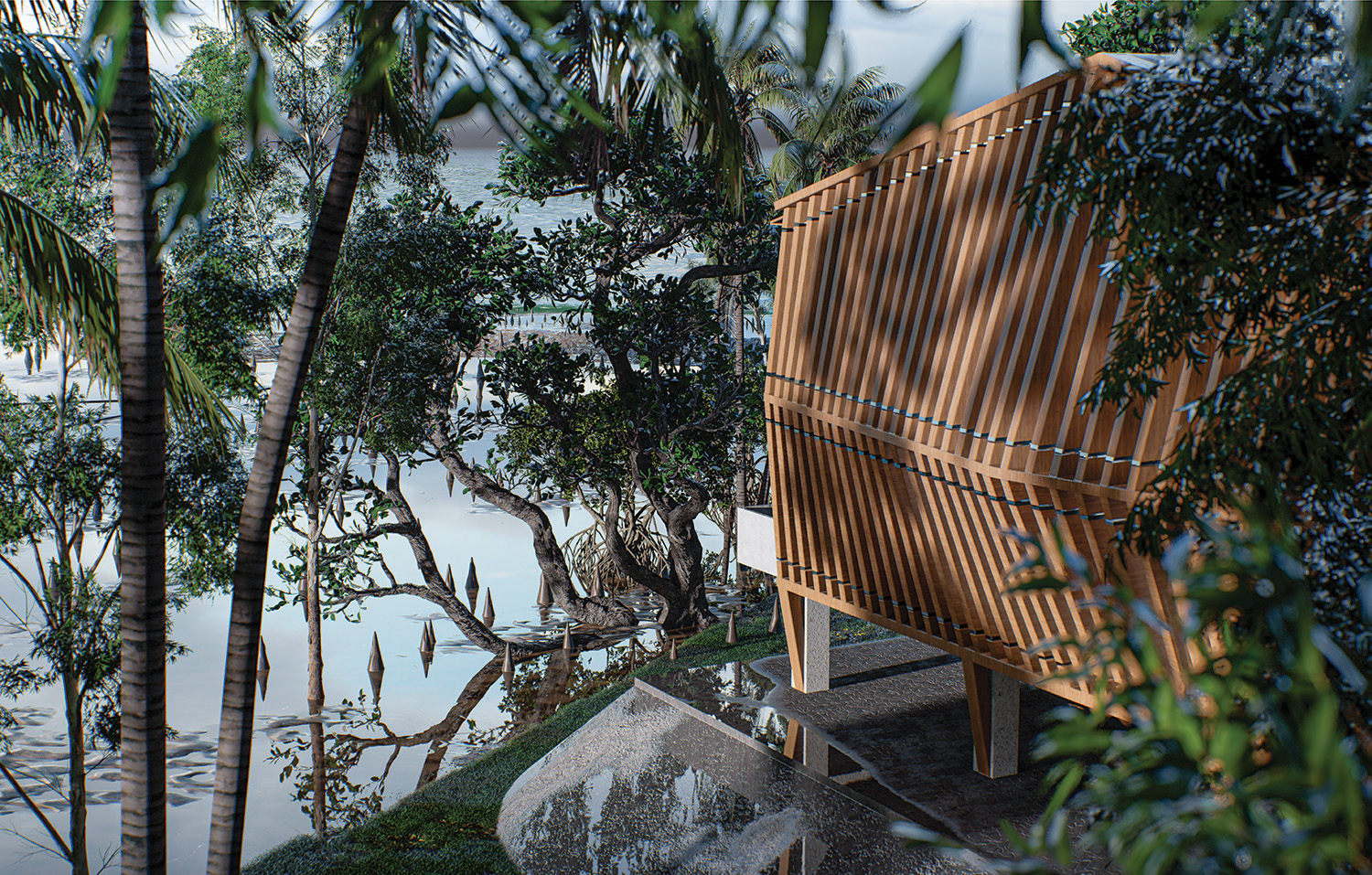
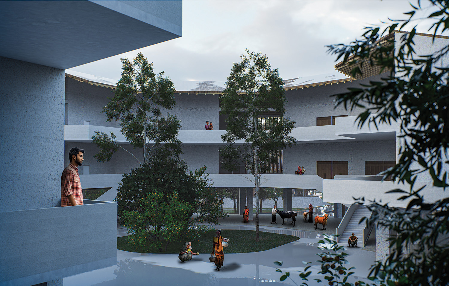
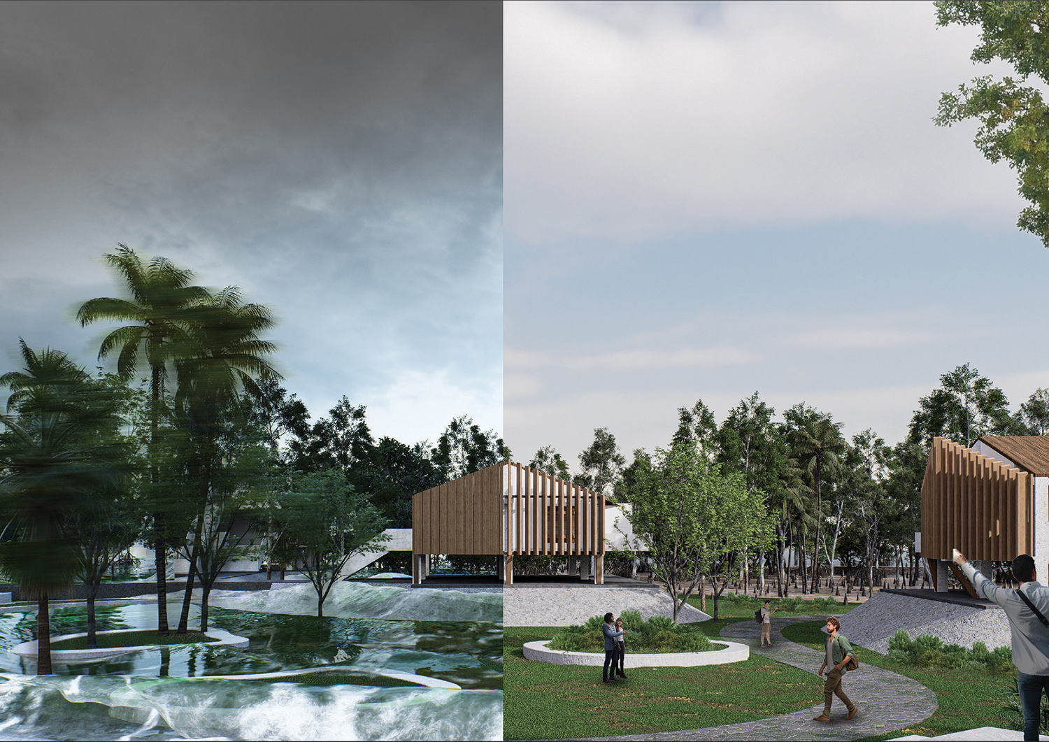
To address cyclonic wind hazards, disaster-resilient architecture is introduced. The rectangular inner living unit is protected by an outer structural shell inspired by natural protective systems such as the shells of tortoises and snails. The form is slightly tilted to mitigate wind flow and allow wind to pass through. The external envelope functions as a dynamic operable louver system, which can be closed during extreme weather conditions. The roof is designed with a 25-degree slope, as roofs between 25° and 40° provide strong cyclone resistance. The structure is elevated 2 meters above the spur dike platform and 2 meters above the ground floor, considering that the maximum storm surge inundation can reach up to 3 meters.
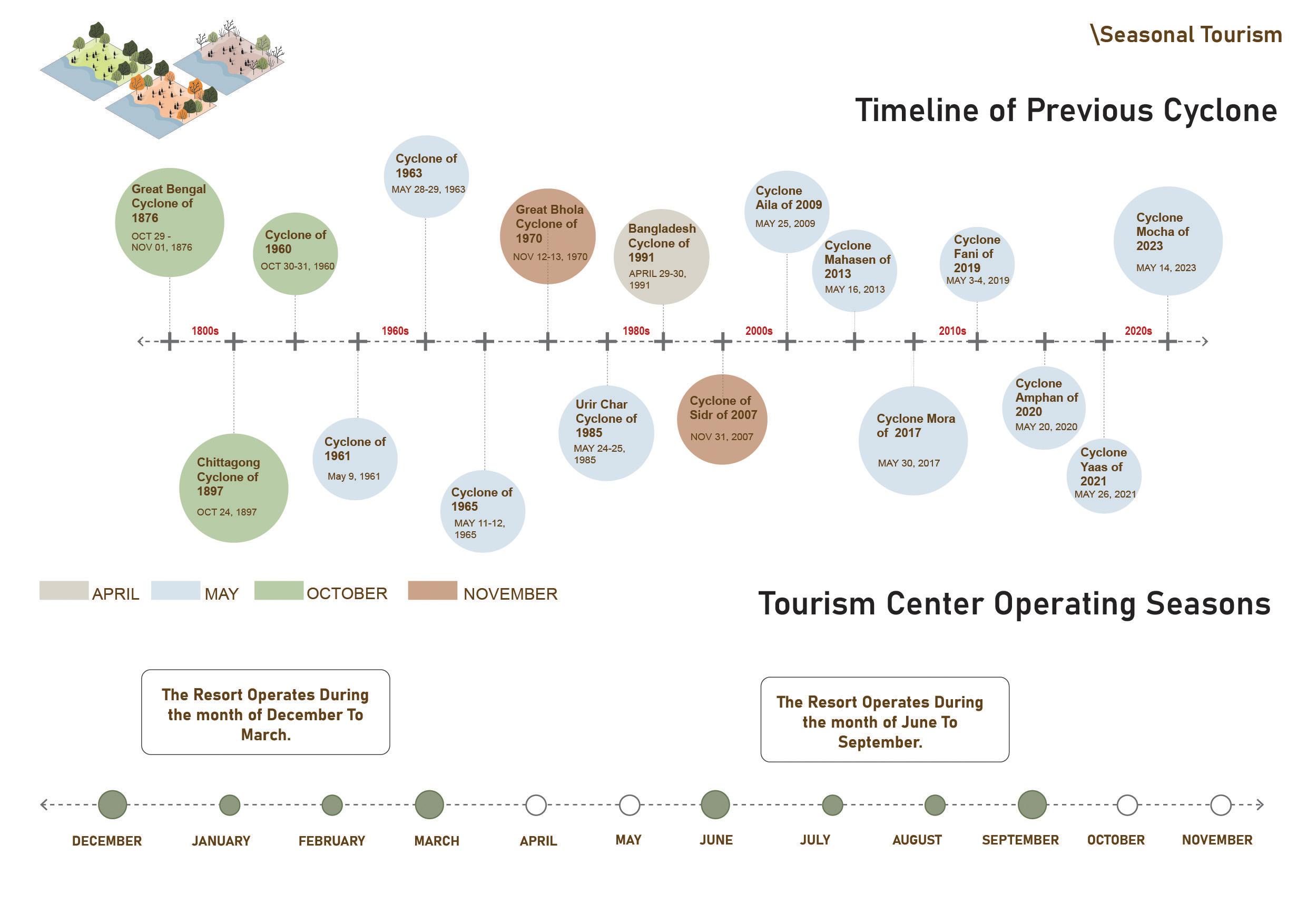
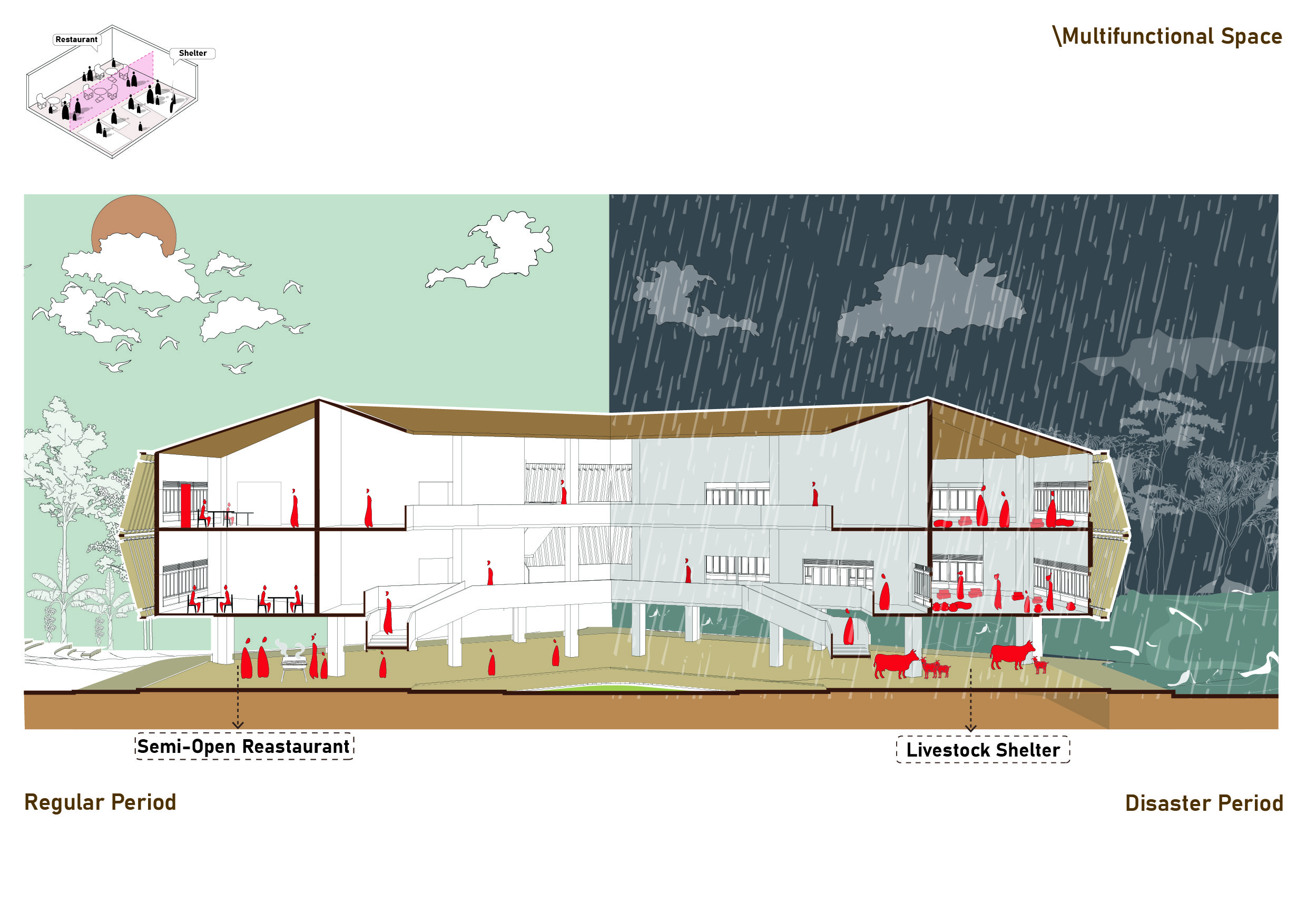
The project also proposes seasonal tourism, where resort operations are suspended during high-risk cyclone months (April–May and October–November). Public spaces are designed as multifunctional areas that can transform into cyclone shelters during disasters. Finally, craft workshops and exhibition spaces are introduced to create alternative livelihood opportunities for local residents. These crafts will also be exhibited, and the making process will be demonstrated live. Tourists will have the opportunity to participate in the craft-making activities, creating both cultural interaction and economic benefit for the community.
Through these strategies, the project proposes a resilient tourism model that integrates environmental adaptation, disaster preparedness, and socio-economic development within the vulnerable coastal landscape of Hatiya Dwip.
PEOPLE ALSO VIEW
Printed Publications

NEXT 50: Collective Futures

ASPIRATIONS AND IDEAS: Designing with Context