Urban solid waste management is a serious environmental issue confronting the cities in developing countries like Bangladesh. Apathy towards the problem, inadequacy of field level information and data, and resource constraints may be blamed for the dismal situation of solid waste management often visible in our cities. In the city of Chittagong, 1037 tons of daily generated waste (0.352kg/cap/day) (1) is dumped in two landfill sites; both being beside major residential areas. The Ananda Bazar landfill site receives about half of Chittagong’s daily generated waste, currently reaching a peak height of 53’, well above the safe height of 13’. This continuation would certainly result in an environmental hazard.
There are certain criteria that are must for a landfill site. These sites must be separated from the habitable areas by using buffer zones, no residential development, and water bodies can be near them. But the landfill site at Ananda Bazar seems to violate all the above criteria and has grown as a result of pure negligence. As a result, the local community is facing severe health hazards along with the serious threats of contaminating the Bay of Bengal.
Currently, 12.41% of all wastes generated in Chittagong are recycled and only 1% is composted (2) but with proper infrastructure, about 70%-80% of waste can be recycled which could lead to a substantial annual earning, according to the research done by the private research body Waste concern. After the intervention, the industry could recycle up to 60% of total incoming waste, and more than 25% of waste could be turned into energy and only 15% would be landfilled.
The aim of this project was, therefore, to design an infrastructure that would explore the possibilities of turning waste into wealth as well as changing the public perception towards the topic. By following an integrated solid waste management approach, the goal was to design a resource recovery facility which would not be harmful to the locality, instead would decontaminate the surrounding and gain capital at the same time. Moreover, how the site can be healed and returned to its original condition and being usable for communal purposes is also explored in the project. These infrastructures are pertinent today as they prove long term solution to dealing with the city’s waste and can dictate how these projects can also be used as public spaces that raise awareness on such issues and not just as public utility buildings.
In this project, the design goal was to introduce an infrastructure that could solve the aforementioned problems of the site and also later be transformed and adapt in accordance with the community needs. Thus, the design process was subdivided into various phases.
In the early phase, there was a need to design an infrastructure to treat on-site garbage and prevent further harm to the locality. In this stage no further waste is piled up in the site, the current waste is treated, and an alternative site is suggested for dumping which fulfills the proper criteria for a landfill. Next, the site is healed through phytoremediation where the goal is to help nature reclaim what was once hers by planting suitable vegetation. Finally, the end goal is to make the site usable for communal use. Guidelines are given for future use of the existing infrastructure according to the local development proposals. A sense of reminiscence is created to convey the message to the general. The message is about change; the message is about adaptability.
Team member: Dr. Sajid Bin Doza, Sheikh Rishad Ahmmad Aurnob, Md. Raihanul Hai, Saba Islam, Shajjad Hossain and Saimum Kabir. We also welcome you to join the project by sending your sketches, images along with brief information (email:context.editor4@gmail.com).
The outcome of the pilot project can be viewed here:
How to navigate the map:
On a desktop computer: Click on the marker on the map to enlarge the image along with brief information, source, and credits. Use the arrow key (or slide) to view the next images in the album (if available).
On a mobile phone: Tap on the marker on the map, the name of the selected marker will be shown at the bottom of the screen. Tap on the name to view the enlarged image and information along with the source and credits.
The world of diverse landscape is a matter of sheer wonder. The same core materials create dissimilar experiences, the same mountains in different parts of the world can create varying stories. The landscapes teach us the humane ways of living, for ourselves and other beings of the world. These elements change the definition of home and relationships, amplifies the emotion behind each story. Landscape is a system, it consists of not only the physical object people see with their eyes, it is far more elaborated from the perspective of memories, changing from one personality to another. In the end, a landscape is a space, the presence of elements and figures makes it a place for someone. The contact between human and landscape is crucial, an essential relationship in this universe. Human efforts to find the meaning of the surface lines allow them to grow an attachment with the earth. It makes sure that growth and life happen, in this intense core. Along with portraying realistic landscapes, it is a necessity to illustrate and understand this attachment. It is quite urgent to feel our inseparable relationship with the places we are putting our mark in. The travel illustrations are trying to reach the same goal, by portraying the presence in landscape. Walking on the rocks of majestic mountains, catching the sunlight in the waves of water, the growth of life in the ancient red brick walls or the carcade of new civilization by the river, the illustrations depict all these experiences in a more down-to-earth way, the way it has been known.
Trained to be an architect in Bachelor studies from Brac University, Bangladesh , Sumaita Tahseen have grown primary interest in sustainable architectural solutions, exploration of various landscape systems and design in recent complex urban system. That led her to pursue masters in “Sustainable Architecture and Landscape Design” currently in Politecnico Di Milano, Italy. Parallel to architecture, she has nurtured immense interest for art and design, being passionate about sketching, conceptual illustrations, exploring different color combinations in abstract paintings and have had few exhibitions of these artworks.
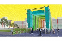
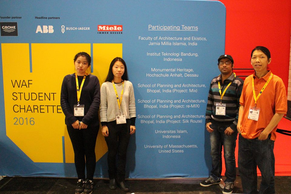
The featured graduate studio project explores the architectural and urban design approaches relevant to situations when new meets old in the built environment. In Berlin, Germany context, the exercise highlights adaptive reuse concepts in regenerating an urban brownfield along the River Spree. Students were guided to follow the HUL (Historic Urban Landscape) guidelines for the additions and alterations to historic places. With the recommendations from the studio instructors, the project was submitted for special theme ‘MIX’ on the Student Charette competition in World Architecture Festival, 2016. Out of 117 entries, this design along with 7 other projects was selected for the final presentation on 16-17th November in Arena Berlin pavilion in Berlin.
The location of the design intervention site is in East Berlin upon the River Spree and accessible by U+S Bahn service and the nearest station is Ostbahnhof. It stretches between Holzmarktstraße (north) to Köpenickertstraße (south) and Michaelkirchstraße (west) to Der Schillingbrücke (east) (Figure 1). The site included two historic buildings: an ice factory (Eisfabric) of 19th century at the right corner of the site) and an egg cooling station (Eirkuhler), these are only of their kinds in Berlin that are still surviving today and enlisted as protected heritage buildings by Archaeology Department (Denkmalschutz). This area is under a great threat to the proposed master plan of MediaSpree by Berlin Senate from the 1990’s. The master plan aims to relocate Broadcaster companies over 440 acres of land across the shores of River Spree. This ignited protests against the privatization of such public places with public funds. Such projects will also raise the tenant rents; create adverse impacts over their livelihoods and limit their earnings. A serious political concern is also involved, as leftist social democratic party, SPD and environmentalist Green Party backed their protest since 2008. Internationally, such event exploded debates among the concerned experts of urban heritage conservation as any historic buildings and public places are being destroyed or losing their authenticity and integrity to accommodate contemporary need.
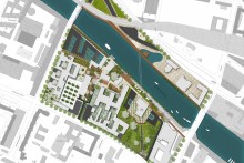
Figure 1: Location of the design intervention site in the overall context of BerlinFigure 2: The existing cultural hub of Holzmarkt on the opposite side and its informal character (Source: author)Figure 3: Existing conditions of two industrial heritage buildings (Source: author)
A daylong trip in Berlin was arranged for an extensive site survey where several emergent questions were asked to inhabitants to investigate their protest, dream and challenges so far they have faced. They think open public spaces over the river shore are getting extinct in Berlin which pushed them to an end: “Spree riverfront for all”. The city dwellers own it and they will decide its fate. The inhabitants/ residents will not allow or trust any other authorities for such ‘Tabula Rasa’ practice. This unique site provides them intimacy with the nature, its freshness and calmness also provide them space to isolate from the hustles of metropolitan life. It poses vibrant urban cultures like beer and party clubs, cuisine, quality pastime for friends and family. It is also epicenter of Berlin’s graffiti art, thus became meeting and greeting places for the artists and sculptors (figure 2). However, there are some security and social glitches due to drug dealings and homeless people’s unhygienic ghettos (figure 3). Lack of parking space is another challenge in this area and is in high demand by the respondents. Above all, a free river shoreline of 50 meters with greeneries was city dweller’s prime concern.
Figure 4: Site and surrounding area analysis to find site’s inherent properties and potentials. (Source: Author)
Analysis is done by the author for better understanding of existing spaces’ essences and freehand sketches revealed natural characteristics: analysis on topography, landscape properties, visual and sonic qualities, climatic features, built environment, physical or man-made characteristics, pattern of urban fabric, figure-ground and reverse figure-ground, street network, spatial organization, hierarchy of open spaces, architectural typologies and images of Kelvin Lynch (path, districts, edges, landmarks and nodes). These analyses were used to distinguish the scopes and strategies in design decisions. Such analysis shows that the entire site owns many positive aspects and the residents have great interaction and expectations over this memory built-up spaces (figure 4).
Figure 5: The black masses representing additional footprints with existing built forms (grey) and two enlisted industrial heritage buildings (brown). Source : AuthorFigure 6: The heritage buildings, Eisfabric and Eirkuhler were respected in design proposal by merging the new built forms with landscape. Source: authorFigure 7: The Axis, connecting series of spaces and experiences into a single force. Source: AuthorFigure 8: Adaptive reuse of heritages and site renewal on the basis of collective memory in Spreemix proposal. Source: author
Collective memories1 of the city residents found from field surveys were used to derive the Adaptive reuse2 principles for the overall site. Despite having historic segregation after WWII, the site remained like a ‘socialist tissue’ that gives the actual essence of the Berlin Wall and once its historic surroundings from DDR era (Former democratic republic of Germany, known as East Germany). But some mixture with eastern Berlin to western Berlin is still missing. The site’s neighborhood and the two shores of Spree River might be linked by a ‘Bridge’ to germinate a connection hub. The famous Bridge of BAUHAUS inspired as a connecting idea.
The prior challenge was how to tie the abrupt and abandoned heritage buildings, its adjacent river shores, and cultural activities on the opposite side with neglected landscape spaces of the overall site into a single axis. The proposed design intervention will start creating dialogues between leftover spaces with the mild interventions, which proposed as ‘Spreemix.’
Figure 9: The entrance of Axis divided the site into two halves which were designed as a mound, will change their recreational mood according to seasons. The new buildings respecting the historic Eisfabric building merged with the landscape by their sloppy character. The old premise is proposed as an ecological museum for Spree River’s biodiversity. The river shore is left vacant for 50 meter. Source: author
Such ‘mixing’ will provide potential diversity and offer experiences to explore various hierarchies from different directions: above and around and also surroundings. Its entrance invites the visitors with water fall sounds and gradually takes them to the river bed area where people will explore a vast tunneled aquarium equals to the width of the river stretching 25 meters in length. The underwater and transparent glass aquarium will showcase the ecological settings and 56 species of fauna of river Spree. Below the average depth of water (5 meters), the tunnel is adjacent to the riverbed, so that it might not cause any navigation problem and ensure the clearance for underwater view inside. Such aquarium is something new and unique, which the city of Berlin is currently ‘not posed with’ but later can be proud of (figure 6, 7).
Figure 9: The greenhouse (grey) for winter cultivation and aqua agriculture (blue) for summer, accumulated with the heritage building (off white) which will host the flora museum of Berlin. Source: Author
Incentives to convert the brownfields into suitable green spaces are only possible through reviving its lost landscape under the HUL recommendations3. The stepped sandy river shoreline remains undisturbed with existing greens by maintaining a distance of 50 meters, which was the prior demand of the protesters. On the east side, a serpentine greenhouse with a series of courtyards was proposed from the inspiration of existing court configurations and modeled after the prevailing human walk flow.
In design intervention, both indoor-outdoor harvesting options were provided to respond with the weathers of winter and summer respectively. Inside the transparent green house, various types of trees are proposed so the site will not be a barren snowy field in the coldest months like January (when the temperature drops to -10C). The greenhouse is attached to the Eirkuhler building which is converted as Flora museum in the design proposal ( figure 8,9).
Figure 10: A much needed parking area was created. Defining the west edges on road side has ensured a series of courts, which is identical in berlin’s built typology. The left over corner is designed as secondary entry to the Greenhouse with soft pavement and vegetation. Source: Author
The surrounding built spaces of Eisfabric building (Ice Factory) are designed in such a way that both new buildings seem to bow down and showing respect to the monument. These are ornate with roof terrace and glassy facades so that users can enjoy the proximity of industrial heritage turned into a Fauna Museum (figure 9). These factories were responsible for polluting this city once, turned into lungs for its dwellers by the dint of adaptive reuse. Such river-based ecological museums do not exist before in Germany, even in a populous city (3.4 million) like the capital Berlin. During the snowfall, these engulfing building’s roofs and surrounding landscapes will become skating rink. During the summer time, recreational and leisure spaces in the mounds beside the entrance are designed to accommodate a barbeque zone, playing spots for children, dog walking path etc. The design also generated a parking area with a capacity of 108 vehicles in middle (figure 10).
Figure 11: Source: Author
Figure 12: Source: Author
The opposite side of the river is already a well-established vibrant cultural center. Its exhibiting a perfect combination of informal architecture: used ships, abandoned containers, broken deck etc. This informal character was not erased, rather improvised with feasible, integrated and innovative environment in the design proposal. Only a free built form of structural skeleton in a flip footprint compared to Ostbahnhof Rail tracks is proposed to minimize the dominant sonic and visual force of the railway station over the whole Holzmarkt area. It was designed to conform the maximum building height restriction of 22 meters for Berlin. Its ground floor will be a free flowing double floor height built form and will include diversified functions like pubs, food courts, music stations, night clubs, rides etc. There will be free accessible lots in the upper floors for painters, Graffiti worms and sculptors. These floors are proposed to host regular exhibitions, conferences, symposiums and seminars, sale center for art pieces and antiques (figure 5,8).
1. It is a tool and trend that the people of certain area used to do with hereditary and leaving marks of it in the places by everyday activities which could be both intangible and tangible at the same time.
2. It is a changing or existing pattern of use for any heritage site or built form which will ensure sustainable functioning in todays’ and future needs.
3. Sustainable development frameworks in the historic city districts are recommended by UNESCO’s 36th session in 2011, known as Historic Urban Landscape (HUL) initiative including the motto “New life for historic cities”. It defined some prerequisites from a holistic and integrated approach to balance contemporary urban infrastructures with existing cultural heritages.
CONTEXT contributing editor: Dr. Kishwar Habib, Ph.D. in Architecture and Urbanism, K. U. Leuven, Belgium.
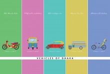
Public transportation began with a simple horse-drawn carriage and quickly progress to rail lines, cable cars and finally modern buses we know. There is no significant data that implies exactly when buses came in Asia for transportation. But even in 1940 most Asian countries, residents were served by bus service (Barter P., 2000).
In S.M. Abul Hossain’s words, who is the ex-president of the Bangladesh Crime Reporter Association, buses from Momin Motor Company were very popular in Dhaka between 1940 to 1970. Those buses were known as ‘Murir tin’ but the history behind the name is unknown. Though it was assumed that because of its shape and material it was called ‘Murir tin’. In 1940, a businessman named Abdur Rahman and his family import Bedford bus from England and also construct a garage named ‘Momin motor company’. Till 1970 those buses gave services continuously even in the middle of the 80s it was routed through Jinjira to Ruhitpur. Since then, travelling by bus has become the most convenient public transport system especially among the students due to affordable fares and accessibility in Dhaka. According to the Bangladesh Road Transport Authority (BRTA), the total number of registered buses until March 2018 is 44,374.
A car is a motor-wheeled vehicle used for comparative fast and easy transportation. Car came into global use during 20th century. In 1986, a German inventor Karl Benz introduced 1st modern car named Benz Patent-Motorwagen.
The first car introduced in Dhaka was owned by Nawab Salimullah. In the year 1904, it was bought from Kolkata and brought to Dhaka. The Nawab family had a private car dealership for them which went by the name Dhaka Nawab Family Automobile (Alam D.,Roy A., 2018). The first and only motor workshop in Dhaka was ‘Excel motor workshop’ run by the British and situated in Nawabpur. Mawla Baksh, who joined as a foreman was given the workshop in 1932. In Farashganj he started his own business which was taken by the British in World War II. In 1942, he got his workshop back and move to Laxmibazar. Pragoti Industries Limited (PIL) is the oldest and largest automobile assemblers in Bangladesh since 1966. The Company has assembled over 50,000 vehicles. According to Bangladesh Road Transport Authority, in 2018, registered private passenger motor car are 3, 35,660 unit.
An auto-rickshaw is the motorized version of pulled or cycled rickshaw with a different physical appearance. A compressed natural gas (CNG) auto-rickshaw is now a very popular form of vehicles in Dhaka which use high pressured natural gas. Natural gas vehicles were first recognized as early as in the 1930s. Japan was the first country to encourage motorized three-wheeled vehicles. It ran on uncompressed gas which was called ‘Gas Bag vehicles’. Those vehicles were also used during World War I even in World War II.
A CNG conversion for vehicles was conceived in Bangladesh to eliminate serious emission problems and due to environmental concern. In 1982, Petrobangla on behalf of the government undertook a pilot project for the use of CNG. Till now, five CNG conversion, filling and marketing stations have been operating in different points of Dhaka City – Joarshahara, Mohakhali, Motijheel, Asad Gate and Kalyanpur under the management of Rupantarita Prakritic Gas Company Ltd (RPGCL), a subsidiary of Petrobangla. After a long period, in January 2003, classic auto-rickshaws were finally banned and CNG-powered model was introduced.
A motorcycle is commonly known as a two-wheeled motorized vehicle. It was created as a self-propelled bicycle for a faster and easier journey experience. In 1884, the first commercial three-wheeler was designed. After 1-year first internal combustion petroleum-fueled motorbike was built in Germany with two wheels.
During 1900, many manufactures were converting bicycles or pedal cycles with motor engines. In 1977, Walton motors first introduced themselves as the manufacturer of the motorcycle in Bangladesh. Over time, because of the traffic and road condition, the motorcycle has become the most popular choice. Many riding apps have been also set up and got a huge response among youths. According to the Bangladesh Road Transport Authority (BRTA), the total number of registered motor vehicles until March 2018 is 21, 45,659.
A rickshaw is a popular transport in Bangladesh which denoted as a three-wheeled passenger cart pulled/cycled by one man. Since it’s invention it took several years to come to the south Asian region especially in Bangladesh. In the late 19th century hand-pulled rickshaw emanated to Asia.
There are various stories about how rickshaw came to Dhaka. From the book named ‘The rickshaws of Bangladesh’ written by Rob Gallagher, apparently in 1930s, rickshaws first came to Mymensingh and Narayanganj, then it arrived in Dhaka. Muntasir Mamun also stated that rickshaw came to Dhaka in 1937. Satyen Sen, in his memoirs, says two persons brought rickshaw from Chandannagar (now in West Bengal, India) in 1936-37. So, it can be assumed that, between 1930-1940, rickshaws were introduced. Licenses for rickshaws were officially distributed from 1944 and the number was 100 then. Soon after, it had become the most popular transport for the people in Bangladesh.
Alam,D., & Roy,A. (2018). Early Transportation System of Dhaka and Its Evolution, Urban ARC 2018: City and Technology: IIHS Annual Research Conference. URL
Bangladesh Road Transport Authority. (2018). Number of registered motor vehicles in Bangladesh (year wise), Report. URL
Emu,H.E., (2020). Murir tin and Momin Company Bus. news article, Amader Somoy. com, URL
Khan,A.U.Z., & Mitra, S. K. (2011). Transportation Infrastructure of Dhaka City: Status and Challenges. URL
About the Authors:
Md. Ibrahim Badhan has completed the bachelor in architecture from North South University (NSU) and is currently doing M.Arch from Bangladesh University of Engineering and Technology (BUET).
Rubaiet Sharmeen Sornali has completed the bachelor in architecture from North South University (NSU) and is currently doing M.Arch from Bangladesh University of Engineering and Technology (BUET).
The interior design of the Head Office of Guardian Life Insurance Limited (GLIL) is the second project of ARCHVISTA, which has been awarded LEED Platinum certification. It is noteworthy that only a total of three projects in Bangladesh have been awarded this certification under the commercial category and two of those projects have been designed and implemented by ARCHVISTA.
Keeping the constantly changing workplace standards in mind, the initial design concept was based on the loop of “focus-collaborate-learn-socialize”. In the age of planetary urbanization, a large number of the global population is spending one-third of their daily time in the office space. Hence, it is of great importance to design an office space that is not only functional but also comfortable.
With special attention to the positive correlation between workplace collaboration and productivity, the key design factors included: Identity, Inspiration, Healthy-Workplace, Team spirit and Choice, which helped ARCHVISTA to design an office that would suffice a healthy work environment while ensuring “working comfort“ and “visual coherence”. Consequently, a synergy formed resulting in an open and attractive workspace with the combination of maximum daylight and ample supply of fresh air.
The full-height windows with a 360-degree view of the Hatirjheel Lake and Gulshan-1 were fully utilized by the design team to ensure the penetration of optimum daylight and its beneficial rays inside, alongside minimal solar heat gain and glare, for an improved mental health and energy efficiency. Additionally, LED lights with daylight sensors are installed throughout the whole floor. These lights will only turn on when the LUX level of an area reaches 150 lux. Moreover, lights with occupancy sensors are also installed which would only turn on when a particular area is occupied by an employee, contributing largely to the energy efficiency and daylight saving of the office, maintaining an energy level of 38.19% and utilizing daylight of 85%.
Here the utmost priority in the design process is the optimum usage of sustainable materials as this was a LEED certification pursuing project. Hence, low VOC (volatile organic compounds) paints, VOC free carpet & Rug were used. Even the tiles were chosen with low VOC content.
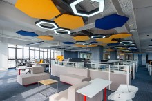
One of the biggest challenges for this project was the HVAC design. In the given floor height, a dropped ceiling could not be designed to conceal the HVAC ducts. Furthermore, these ducts caused sound pollution in the interior. Therefore, hexagonal sound absorbing acoustic panels were designed and installed around the air outlets alongside customized hexagonal pendant lighting.
For all the employees, this office is their second home, which was the biggest challenge to deal with. Thus, a healthy and collaborative work environment was a must. The open layout, with a central alley accommodating the workstations of the executive bodies of the office and side alleys shared by others, encourages the employees to interact, consult, or supervise the team members. Only 30% of the total floor area is partitioned spaces designed with glass enclosures to establish a visual coherence and unobstructed flow of natural light. Furthermore, a number of self-service counters are designed close to the different segments of the workstations which would enable the employees to get off their desks and serve themselves with tea or coffee, resulting in continuous light movements and socialization.
Vertical green walls have been installed along the waiting area to enhance the quality of air inside the
office. These plants are planted on top of hydro falls that circulate the water to the plants for their growth. All the installed water fixtures and fittings are efficient with WELPS labels enabling the office to cut water consumption by 44% compared to the conventional fittings. These fittings include dual flush water closets, water efficient urinals with manual flush, and self- closing delay action taps for wash basin, water-efficient shower fittings, and water efficient sink tap. A particular area in the parking space is provided where the riders of the parked bikes could take a shower using this saved water.
Even all the furniture in the office is eco-friendly and also ergonomically responsive. The strategies namely, Avoid, Reuse, Reduce, Recycle and Dispose are followed very carefully. It helped GLIL to manage their wastes under the categories: Paper, Plastic, Cans and Other wastes.
Moreover, during the construction phase, GLIL had reached another milestone with zero casualties at the site and 95% management of construction waste which is a pre-requisite for the LEED certification. The site was very carefully chosen by the clients. They made sure the site was easily accessed by public transportation and should also be accessible to a number of social services. Hence, users can access the maximum number of social amenities within ten minutes of the walking distance. It is because of this accessibility that made the construction phase a sustainable practice as the transportation of construction materials took lesser time and hassle.
While for many cities and towns of developing countries, the rising curve of pollution level is pronounced, Rajshahi’s air is getting cleaner. Thanks to the tree plantation campaign that began in 2004, and now the city excels at garbage and waste management, making Rajshahi one of the cleanest cities in Bangladesh. As initiatives like the construction of citywide sidewalks and riverfront redevelopment is in progress, a well-designed urban movement network encompassing safer, well connected walking infrastructure in combination with improved public transport is essential to enhance its vitality.
The following student proposal for ‘walkable Rajshahi’ has prioritized people-centric urban development to celebrate living locally with everything that one needs and admires. The idea is to transform future Rajshahi into a humane and sustainable city with active street life and a high-quality public environment where local businesses and communities will thrive. – Editor
Rajshahi, one of the major divisional cities of Bangladesh, is becoming a city for developers, financiers, and portfolio property owners, but not for people! City’s transport infrastructures are primarily built to serve the commuters using automobiles to maintain their daily activities such as dropping their children at school, scooting off to work, picking up the shopping etc.
This thesis project is an attempt to explore the potential of urban design in transforming the public life of Rajshahi city into a more exciting, vibrant and walkable urbanity by shifting the focus on the improvement of pedestrian flows and facilities rather than on cars and parking.
Walkability is not only a pedestrian movement of people; it is a measurement of the overall walking condition in a city or a particular area. It depends on how the built environment is friendly for people doing their necessary, social, and optional activities. Several factors affecting the flow of pedestrians including land use, street connectivity, residential density, orientation, proximity of homes, active street frontage, placemaking, street design features, etc. Furthermore, it depends on the presence of walking and biking networks connecting all the major destinations and mass transit points. Quality of walkways, buffers to moving traffic (planter strips, on-street parking, or bike lanes), pedestrian crossings, air quality, and street furniture and sheds all these give a reason while ensuring safety, security, and comfortable settings that stimulate walking.
Welcoming bikes, planting trees, getting parking right, mixing the use of spaces, protecting the pedestrian, reshaping the areas, improving the mass transit, putting cars in their place -these are the proposed strategies to make Rajshahi a walkable, attractive, healthy, sustainable, and lively city.
Due to large rural to urban migration, Rajshahi city is expanding rapidly day by day. Today more than 7.6 lac (0.7 million) residents live in this city (Bangladesh Bureau of Statistics, 2011). Residents contribute to the vitality day and night, going about their daily chores. Another interesting character of Rajshahi is that the existing commercial, educational, open spaces, as well as green and water bodies are well spread out all over the city which has the potential to regenerate a vibrant environment and break the mundane lifestyle of the residents.
In the public life survey report, 97% of people do not use the private car, and the largest amount of people use non-motorized vehicles (Rajshahi City Corporation, 2014). However, the major part of the streets of Rajshahi is dedicated to the automobiles; small footpath can barely be found at the edges. On top of that, open dustbin, construction materials, etc. occupy the footpath, which gives a painful and unpleasant experience to the pedestrian and demotivates them to walk. On the other hand, fruit and street food shops, small passageways, flower shops, street furniture, and amenities are also available on the streets, which pulls the urban people.
Five major streets and nodes that structure the city are Grater road, Hadir morh, Kumarpara, Nator road, Gonokpara. For citizen’s daily and occasional activities, their destination points are for food, clothing, shopping, religious, educational, and health facilities. Locating these points, we can find out the most used street is Shahab Bazar road (Nator road), which is parallel to the river Padma. From this road, one can quickly move towards the neighborhoods or the riverfront or any other destination points. Hence, the proposal comprises strategies to requalify the existing car-based road system into a safe, inclusive and serviceable movement network to accommodate a diversity of transport modes and support activities including pedestrian priority streets.
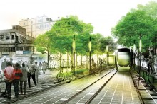
In this proposed movement network, a loop was created to develop pedestrian-oriented development with facilities for public transport interchanges so that people can move to the destination points within five minutes or a 400 m walk.
Also, the emphasis is given on the considerations to make a mixed-use and lively street. Some asphalt roads are downgraded by changing the paving materials and redesigning the lanes based on user hierarchy. A circular tram line with a station at every 400 m ( 5-minute walking distance from the station to station) is also proposed. A dedicated bicycle lane is also introduced along with greening and amenities which are essential for creating a more comfortable, safe and active street environment.
References:
Bangladesh Bureau of Statistics (BBS). 2011. District Statistics: Rajshahi, Bangladesh Bureau of Statistics (BBS).
Rajshahi City Corporation. 2014. Transport Situation in Rajshahi. Rajshahi : Rajshahi City Corporation.
It is impossible to miss the curving and sinuous structure located in Paris’s 16th arrondissement, which has the bearing of a ship built of glass, a building in motion, continually slipping and flowing. This iconic building is the Fondation Louis Vuitton; the museum and cultural centre designed by modern architecture’s greatest transformer of shapes, Frank Gehry—the Pritzker prize-winning designer whose iconic buildings such as the Bilbao Museum, the Guggenheim, and the Walt Disney Concert Hall have earned him the status of a household name. In this interview (hosted by filmmaker Emile Rafael & presented by NOWNESS), Mr. Gehry speaks about his design philosophy & inspiration, his passion for breaking the norm by rethinking the concept of form, shape & space, and his love for art in all its guises, including how architecture is often overlooked as an art form in itself.
The interview is translated in Bengali by architecture graduate Mahin Haque and the feature image is illustrated by Ziaur Rahman Ovi.
প্রত্যেকটি মানুষের সিগনেচার আলাদা; স্বতন্ত্র। আপনার স্বাক্ষরের সাথে আমার স্বাক্ষর মিলবে না। আপনি পাশাপাশি দুইজন ব্যক্তির স্বাক্ষর তুলনা করলে সেখানে খুঁজে পাবেন বৈচিত্র্যতা; এবং বিষয়টি স্বাভাবিক। একইভাবে দুইজন মানুষের রুচি ও মননে ভিন্নতা থাকে, সৌন্দর্য্যবোধ আলাদা হয়। আমার রুচিবোধের সাথে সবার রুচিবোধ মিলতে হবে এমন কোন কথা নেই। একই জিনিস কারো কাছে খুব আকর্ষণীয় মনে হতে পারে, আবার কারো কাছে তা হতে পারে নিতান্তই সাধারণ কিছু! এই সৌন্দর্য্যবোধ কি পরিমাপ করা যায়? একে কি কোনভাবে ছকে বেধে সংজ্ঞায়িত করা যেতে পারে? না। আমি মনে করি, এ ধরনের তুলনার আদৌ কোন প্রয়োজন নেই। আপনার রুচিবোধ আপনার কাছে, আমারটা আমার কাছে। বৈচিত্র্যের মধ্যেই সৌন্দর্যের তৃপ্তি।
স্থাপত্যের ভাষা
স্থাপত্যের অনন্য নিদর্শনগুলোর মধ্যে একটি মিল আছে; তা হলো এদের মাধ্যমে অনুভূতির বহিঃপ্রকাশ ঘটে। তাজমহল বলুন, পিরামিড বলুন কিংবা আইফেল টাওয়ার, প্রত্যেকটি গুরুত্বপূর্ণ স্থাপনার মধ্যে তার নিজস্ব এক ধরণের অব্যক্ত ভাষার প্রকাশ বিদ্যমান; যেখানে তার স্বয়ং উপস্থিতিই দর্শনার্থীদের মনে এক ধরনের অদৃশ্য আবহ তৈরি করতে সক্ষম। আপনি যখন এসব জায়গায় যাবেন এবং আনমনে স্থাপনাটির সামনে যেয়ে দাঁড়াবেন, অনেকটা নিজের অজান্তেই আপনি সেই স্থাপত্যের অলিখিত ভাষাটুকু বুঝতে পারবেন, হৃদয়ঙ্গম করতে পারবেন তার অপার মহীমা। অনেকটা বইয়ের পাতায় লেখা গল্পের মত; যেটা আপনি চাইলেই যে কোন সময় পড়ে নিতে পারেন। এভাবেই যুগ যুগ ধরে এসব স্থাপনার মাধ্যমে তাদের নির্মাতা শিল্পী ও স্থপতিদের মনের আবেগ ও অনুভূতিটুকু স্থান, কালের গণ্ডি ভেদ করে দর্শনার্থীদের মধ্যে প্রবাহিত হয়।
আবার মুদ্রার ওপিঠও আছে। ধরুন, আপনি প্যারিসে একটি আর্টের ভবন তৈরি করতে চান। এখন কাজ শুরুর আগেই কিন্তু আপনি এক প্রকার বিপদে পড়ে যাবেন! প্যারিসে এত এত অনবদ্য স্থাপত্যের নিদর্শন, অমর কীর্তি- যে, আপনাকে সূচনাতেই এক অভাবনীয় প্রতিযোগিতার মধ্যে পরে যেতে হবে। আপনার নতুন স্থাপনাটি কি প্যারিসের শৈল্পিক স্থাপত্যসম্ভারের মধ্যে জায়গা করে নিতে পারবে? সাধারণ মানুষ কি এই নতুন স্থাপত্যটিকে গ্রহণ করতে পারবে? আমি জানিনা; এরকম পরিস্থিতিতে আমার মধ্যে একটি অনিশ্চয়তা কাজ করবে, এবং এই পুরো বিষয়টি আমার জন্য অত্যন্ত রোমাঞ্চকর!
স্থাপত্য ও শিল্প
বেশিরভাগ মানুষ স্থাপত্যকে আর্ট বা শিল্প হিসেবে বিবেচনা করতে চায়না। এর কারণও আছে। স্থাপত্য শুধুমাত্র আর্ট বা শিল্পের প্রতিনিধিত্ব করেনা; বরং এর মধ্যে মানবিকতার অন্যান্য গুণাবলীর মাপকাঠি বিরাজমান। একটি স্থাপনা যখন তার ব্যবহারকারীদের কাছে গ্রহণযোগ্য হয় তখনই সেটি পরিপূর্ণ স্থাপত্য হয়ে ওঠে। আপনি যে ভবনটি ডিজাইন করছেন তা হবে সার্বজনীন; সকল শ্রেণী ও পেশার মানুষের জন্য একটি নিরাপদ আশ্রয়স্থল, মাথা গোঁজার ঠাই, সর্বোপরি নির্ভরতার প্রতীক। আমি এ ব্যাপারে একমত যে স্থাপত্যের প্রথম ও প্রধান উদ্দেশ্য হচ্ছে এটি তৈরি হবে মানুষের ব্যবহারের জন্য। কিন্তু এটাও ঠিক যে, স্থাপত্যের এই প্রায়োগিক বৈশিষ্ট্য অনেক সময় স্থাপত্যের শৈল্পিক বিকাশে প্রতিবন্ধকতা তৈরি করে। অর্থাৎ, এটি এমন এক ধরনের সীমাবদ্ধতা, যা স্থাপত্যকে তার ব্যবহারিক প্রয়োজনীয়তাটুকু পূরণ করার মধ্যেই সীমাবদ্ধ করে ফেলতে চায়। স্থাপত্য তখন একটি ছকের মধ্যে আবদ্ধ হয়ে পরে। কিন্তু আমি মনে করি, এই ছকের বৃত্তটুকু ভেঙ্গে স্থাপত্যকে শিল্পের পর্যায়ে নিয়ে যাওয়া সম্ভব; কারণ, স্থাপত্য ও শিল্প কিন্তু পরস্পরবিরোধী নয়, বরং একে অপরের পরিপূরক।
“অতীত” থেকে প্রেরণা
স্থাপত্যে মডার্নিজম (modernism) একটি বৈপ্লবিক ধারার সূচনা করে। কিন্তু ষাটের দশকের শেষদিকে যখন ধীরে ধীরে মডার্নিজমের গ্রহণযোগ্যতা কমতে থাকে, তখন হঠাৎ করে ইতিহাসের অন্তঃপুর থেকে প্রাচীন গ্রীক ও রোমান স্থাপত্যকলার নির্দিষ্ট কিছু ধারাকে পুনর্জীবিত করার মাধ্যমে ধ্রুপদী স্থাপত্যকে ফিরিয়ে আনার একটা প্রবণতা শুরু হয়, যেটিকে তখন পোস্ট-মডার্নিজম (post-modernism) নাম দেয়া হয়। ব্যক্তিগতভাবে, এই সামগ্রীক ব্যাপারটিতে আমার কিছু আপত্তি ছিলো। এবং আমি জানিনা আমি এটা কেন করেছিলাম, তবে আমার মনে আছে পোস্ট-মডার্নিজমের উত্থানের প্রসঙ্গে আমি একবার একটি লেকচারে বলেছিলাম, “আপনারা যে এই একবিংশ শতাব্দীর দ্বারপ্রান্তে এসে দুই হাজার বছর আগের গ্রীক মন্দিরগুলোকে অনুকরণ করার চেষ্টা করছেন তার যুক্তিটা কি! আপনারা কেনো তাহলে ৩০০ মিলিয়ন বছর পূর্বে মৎস্যযুগে চলে যাচ্ছেন না, যখন পৃথিবীতে শুধু মাছেরা বিচরণ করতো! আইডিয়া বা অনুপ্রেরণার জন্য অতীতে যদি যেতেই হয়, তাহলে একেবারে সুদূর অতীতে যেতে বাধা কোথায়!”
আমি আসলে জানিনা এটা কেন বলেছিলাম। এটা অনেকটা স্বতঃস্ফুর্ত ভাবে আমার মাথায় চলে এসেছিলো। কিন্তু এরপর যা হলো, আমি আনমনে বিষয়টা নিয়ে ভাবা শুরু করলাম, এবং অনেকটা মনের অজান্তেই মাছের স্কেচ করা শুরু করলাম! মাছ নিয়ে আকিবুকির এক ফাকে আমি আবিষ্কার করলাম যে মাছের আকার, আকৃতি ও বৈশিষ্ট্যের মধ্যে এক ধরনের গতিশীলতা রয়েছে, মুভমেন্টের বহিঃপ্রকাশ আছে। হুট করে মাথায় আসা এই অবান্তর আইডিয়াটা যেন ছিলো এক অফুরন্ত সম্ভাবনার আধার! আমার সামনে যেন এক অসীম সম্ভাবনার দ্বার খুলে গেলো। আমি দিব্যচোখে দেখতে পাচ্ছিলাম বিভিন্ন আকৃতি ও প্রতিকৃতির সঞ্চারণ, সমাহার। এক সময় আমি এই অপার সম্ভাবনাগুলোকে অনুসন্ধান ও বিশ্লেষণ করতে শুরু করলাম। এক কথায় এটি ছিলো প্যান্ডোরার বক্স (Pandora’s Box) এর মত এক অসীম গোলকধাঁধা, একটি নতুন দিগন্ত, এক নতুন খেলার মাঠ! এবং এই প্রেক্ষাপট থেকেই শুরু হয় আমার প্রচলিত ধারার বাইরে চিন্তা করার মানসিকতা; প্রচলিত ফর্মগুলোকে ভেঙ্গেচুড়ে নতুন কিছু বের করে এনে স্থাপত্যকে অন্য ভাবে দেখার আকাঙ্ক্ষা।
আমি বলবো, আর্ট বা শিল্প তৈরি করার প্রক্রিয়াটা আসলে ভালোবাসার প্রক্রিয়া! এবং এই ভালবাসা সমগ্র পৃথিবীর প্রতি। আমি আর্টের প্রতি ভীষণভাবে অনুরক্ত। অবসর সময় পেলেই আমি আর্ট নিয়ে পড়াশুনা করি, কিংবা গবেষণা করি। আর্টের প্রতি আমার এই বিরামহীন ভালোবাসার উৎস সম্পর্কে আমি নিশ্চিত নই; তবে জীবনের এই পর্যায়ে এসে আমি বুঝতে পারি আমার বেশিরভাগ বন্ধু বা সহকর্মীরাই আর্টিস্ট বা শিল্পী। হ্যা, বন্ধুদের মধ্যে অল্প সংখ্যক স্থপতিও আছেন; তবে আর্টিস্টদের সংখ্যাই বেশি। স্থাপত্যের মধ্যে আর্টকে খুজে নেয়ার যে প্রবণতা আমার মধ্যে আছে সেটাই এর কারণ কিনা আমি জানিনা, তবে আমি মনে করি স্থাপত্যের মধ্যে শিল্পসত্বার উপস্থিতি ও বিকাশের কোন বিকল্প নেই।
প্রাণের স্পন্দন
কিভাবে স্থাপত্যের মধ্যে আবেগ ও অনুভূতির প্রকাশ ঘটে? এমন কোন বৈশিষ্ট্য কি আছে যার উপস্থিতিতে একটি নির্জীব স্থাপনায় প্রাণের সঞ্চার হয়; এবং তা অসার জড়বস্তু থেকে জীবন্ত হয়ে ওঠে? এ এমন এক জটিল প্রশ্ন যার উত্তর আমি নিজেও পুরোপুরি জানি না। অনেক বছর ধরে আমি এই প্রশ্নের উত্তর খুঁজে বেড়াচ্ছি।
ব্যক্তিগতভাবে আমি নৌকা চালাতে পছন্দ করি, এবং নৌকাবাইচ আমার অত্যন্ত প্রিয় একটি খেলা। চলন্ত নৌকা, বহমান নদী ও প্রকৃতির স্বতঃস্ফুর্ত স্পন্দন আমাকে আকৃষ্ট করে, যেখানে গতির মধ্যে স্থিতির বিরাজ! সরলরেখার চেয়ে বক্ররেখার মধ্যেই যেন বেশি আবেগ খুঁজে পাই আমি। চারপাশের বেশিরভাগ ভবন আমার কাছে স্থিতিশীল (static); সাধারণ সরলরৈখিক ফর্মের সমন্বয়ে গঠিত জড়বস্তু বলে মনে হয়। কিন্তু আমার কাছে এই জড়তা ভালো লাগেনা। আমি মুভমেন্ট পছন্দ করি যেখানে অনুভব করা যাবে গতিশীলতার স্পন্দন, অর্থাৎ নদীর স্রোতের মতই প্রবাহিত হবে অনুভূতি! যেখানে মনে হবে কোন কিছু থেমে নেই, সবকিছু সচল; যেখানে স্পেইসের মধ্যে থাকবে চলমান আন্দোলন এবং অনুভূত হবে প্রাণের স্পন্দন। ইট, পাথর, কনক্রিট আর স্টিলের জঞ্জালে আবদ্ধ খাঁচার মধ্যে অনুভূতির এই অনুরণন যদি তৈরি করা যায়, অসার নির্জীব কাঠামোকে যদি জীবন্ত করে তোলা যায়, এর চেয়ে অসাধারণ অনুভূতি আর কি হতে পারে!
একজন স্থপতি এবং একজন শিল্পী হিসেবে এই অনুভূতিটুকুই আমাকে নতুন কিছু সৃষ্টির প্রেরণা যোগায়। সৃষ্টি সুখের স্বপ্নজালে বিভোর আমি একজন ক্ষুদ্র মানুষ, হয়তো এভাবে আমার কাজের মাধ্যমেই আবিষ্কার করতে চাই আমার নিজস্ব স্বকীয়তা, আমার দর্শন; আমার ‘সিগনেচার’।
Institute of fine arts, Dhaka University, commonly known as ‘Charukola’ was designed by Architect Muzharul Islam, the pioneer of modern architecture in Bangladesh and the father of Bengali Modernism. This masterpiece was the first art school in the region and it’s a pathway to find the true genius of Mazharul Islam who championed the art of blending culture, modernism and patriotism. The team revisited the project during this pandemic and inspired by mesmerizing architectural details such as climatic responsiveness, building materials, space arrangement, and construction technique. The reproduction of a three dimensional model of this project was instigated based on the actual images from google’s satellite image and architect Islam’s original drawings from the archive. The proportion of the building with every detail has its own originality and uniqueness. When the model was ready, the team studied the history of this building to create an animation with verified information collected from the book “Muzharul Islam, Architect” published by BRAC University Press and architect Islam’s own speech from the documentary “TINI’’ by architect Enamul Karim Nirjhar.